File:Fort Kaskaskia Illinois Country Map 1778 Cropped.jpeg

No higher resolution available.
Fort_Kaskaskia_Illinois_Country_Map_1778_Cropped.jpeg (569 × 472 pixels, file size: 117 KB, MIME type: image/jpeg)
Captions
Captions
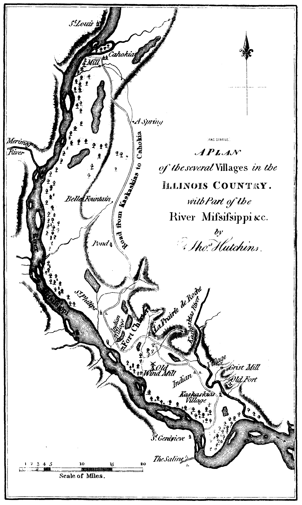
Map from 1778 showing position of Fort Kaskaskia at Kaskaskia Village, Illinois
Summary
edit| Description |
English: Yellow highlighted cropped Map image closeup of the defensive position of Fort Kaskaskia on the bluff overlooking Kaskaskia Village from the 1778 map of the Illinois Country by Thomas Hutchins "Several Villages in the Illinois Country with Part of the River Mississippi &c." (facsimile) by . Printed in Parkman, Francis. The Conspiracy of Pontiac and the Indian
War after the Conquest of Canada, Vol. I, 1851. Page 455. 6th ed., 1870. Project Gutenberg, 2012. http://www.gutenberg.org/files/39253/39253-h/39253-h.htm |
| Date | |
| Source | http://www.gutenberg.org/files/39253/39253-h/39253-h.htm ; specifically image https://www.gutenberg.org/files/39253/39253-h/images/i585.png |
| Author | Thomas Hutchins |
| Other versions |
.png)
Licensing
edit
This work is in the public domain in the United States because it was published (or registered with the U.S. Copyright Office) before January 1, 1929.
|
File history
Click on a date/time to view the file as it appeared at that time.
| Date/Time | Thumbnail | Dimensions | User | Comment | |
|---|---|---|---|---|---|
| current | 22:54, 27 February 2018 | | 569 × 472 (117 KB) | Higher Ground 1 (talk | contribs) | =={{int:filedesc}}== {{Information |description={{en|1=Yellow highlighted cropped Map image closeup of the defensive position of Fort Kaskaskia on the bluff overlooking Kaskaskia Village from the 1778 map of the Illinois Country by Thomas Hutchins "Several Villages in the Illinois Country with Part of the River Mississippi &c." (facsimile) by . Printed in Parkman, Francis. The Conspiracy of Pontiac and the Indian War after the Conquest of Canada, Vol. I, 1851. 6th ed., 1870. Project Gutenb... |
You cannot overwrite this file.
File usage on Commons
There are no pages that use this file.