File:Fort Saint Therese.jpg

Size of this preview: 574 × 599 pixels. Other resolutions: 230 × 240 pixels | 460 × 480 pixels | 736 × 768 pixels | 981 × 1,024 pixels | 2,493 × 2,603 pixels.
Original file (2,493 × 2,603 pixels, file size: 1.72 MB, MIME type: image/jpeg)
Captions
Captions
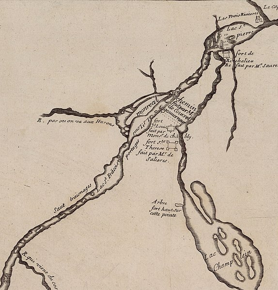
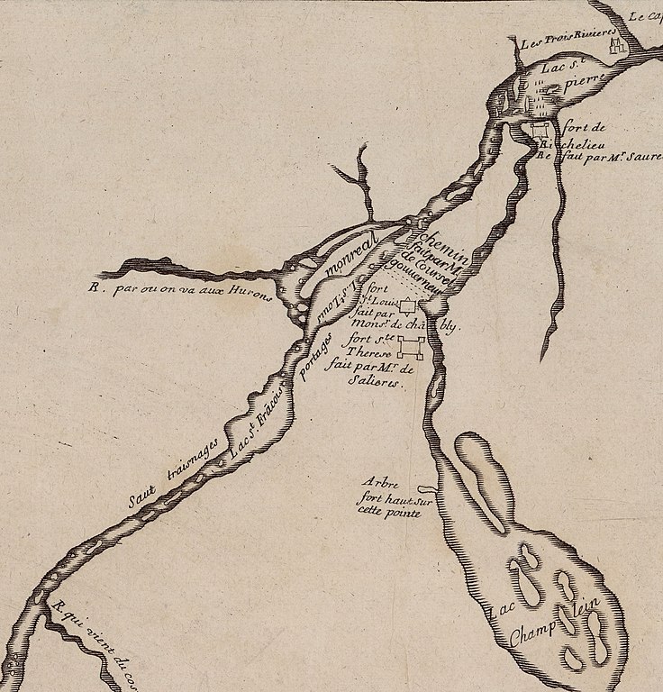
Fort Saint Therese
Summary
edit
| Description |
English: Map of the Forts along the Richelieu River. |
| Date | between 1700 and 1799 |
| Source | https://gallica.bnf.fr/ark:/12148/btv1b8595965s |
| Author | S.N |
| Other versions |
 |
Licensing
edit
|
This work is in the public domain in its country of origin and other countries and areas where the copyright term is the author's life plus 100 years or fewer. | |
| This file has been identified as being free of known restrictions under copyright law, including all related and neighboring rights. | |
File history
Click on a date/time to view the file as it appeared at that time.
| Date/Time | Thumbnail | Dimensions | User | Comment | |
|---|---|---|---|---|---|
| current | 16:54, 21 February 2020 | | 2,493 × 2,603 (1.72 MB) | Eastfarthingan (talk | contribs) | User created page with UploadWizard |
You cannot overwrite this file.
File usage on Commons
There are no pages that use this file.
File usage on other wikis
The following other wikis use this file:
- Usage on en.wikipedia.org