File:Fort du Salbert (3).jpg

Size of this preview: 800 × 533 pixels. Other resolutions: 320 × 213 pixels | 640 × 427 pixels | 1,024 × 683 pixels | 1,280 × 853 pixels | 2,560 × 1,706 pixels | 4,204 × 2,802 pixels.
Original file (4,204 × 2,802 pixels, file size: 7.76 MB, MIME type: image/jpeg)
Captions
Captions
Add a one-line explanation of what this file represents
Summary
edit| Description |
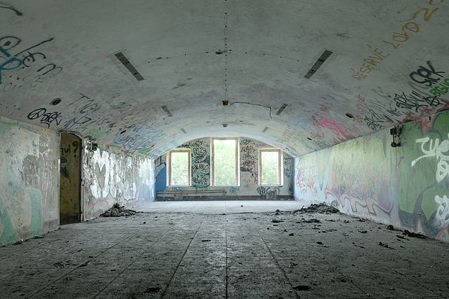
Chambrée du premier étage. Salbert hill fortifications (HDR). |
||||||||||||||||||||||
| Date | |||||||||||||||||||||||
| Source | Fort du Salbert | ||||||||||||||||||||||
| Author |
Thomas Bresson from Belfort, France
|
||||||||||||||||||||||

.jpg&action=edit§ion=1)
| Camera location | | View this and other nearby images on: OpenStreetMap |
|---|
.jpg¶ms=047.659622_N_0006.812950_E_globe:Earth_type:camera_source:Flickr_&language=en)
Licensing
edit.jpg&action=edit§ion=2)
This file is licensed under the Creative Commons Attribution 2.0 Generic license.
- You are free:
- to share – to copy, distribute and transmit the work
- to remix – to adapt the work
- Under the following conditions:
- attribution – You must give appropriate credit, provide a link to the license, and indicate if changes were made. You may do so in any reasonable manner, but not in any way that suggests the licensor endorses you or your use.
| This image, originally posted to Flickr, was reviewed on 14:30, 4 July 2010 (UTC) by the administrator or reviewer Lupo, who confirmed that it was available on Flickr under the stated license on that date. |
This image has been assessed using the Quality image guidelines and is considered a Quality image.
|
File history
Click on a date/time to view the file as it appeared at that time.
| Date/Time | Thumbnail | Dimensions | User | Comment | |
|---|---|---|---|---|---|
| current | 08:31, 4 July 2010 | | 4,204 × 2,802 (7.76 MB) | ComputerHotline (talk | contribs) | {{Information |Description=Chambrée du premier étage. Salbert hill fortifications (HDR). |Source=[http://www.flickr.com/photos/computerhotline/4742655733/ Fort du Salbert] |Date=2010-06-27 20:37 |Author=[http://www.flickr.com/photos/36519414@N00 Thomas |
You cannot overwrite this file.
File usage on Commons
The following 5 pages use this file:
File usage on other wikis
The following other wikis use this file:
- Usage on fr.wikipedia.org
.jpg&oldid=749319236)