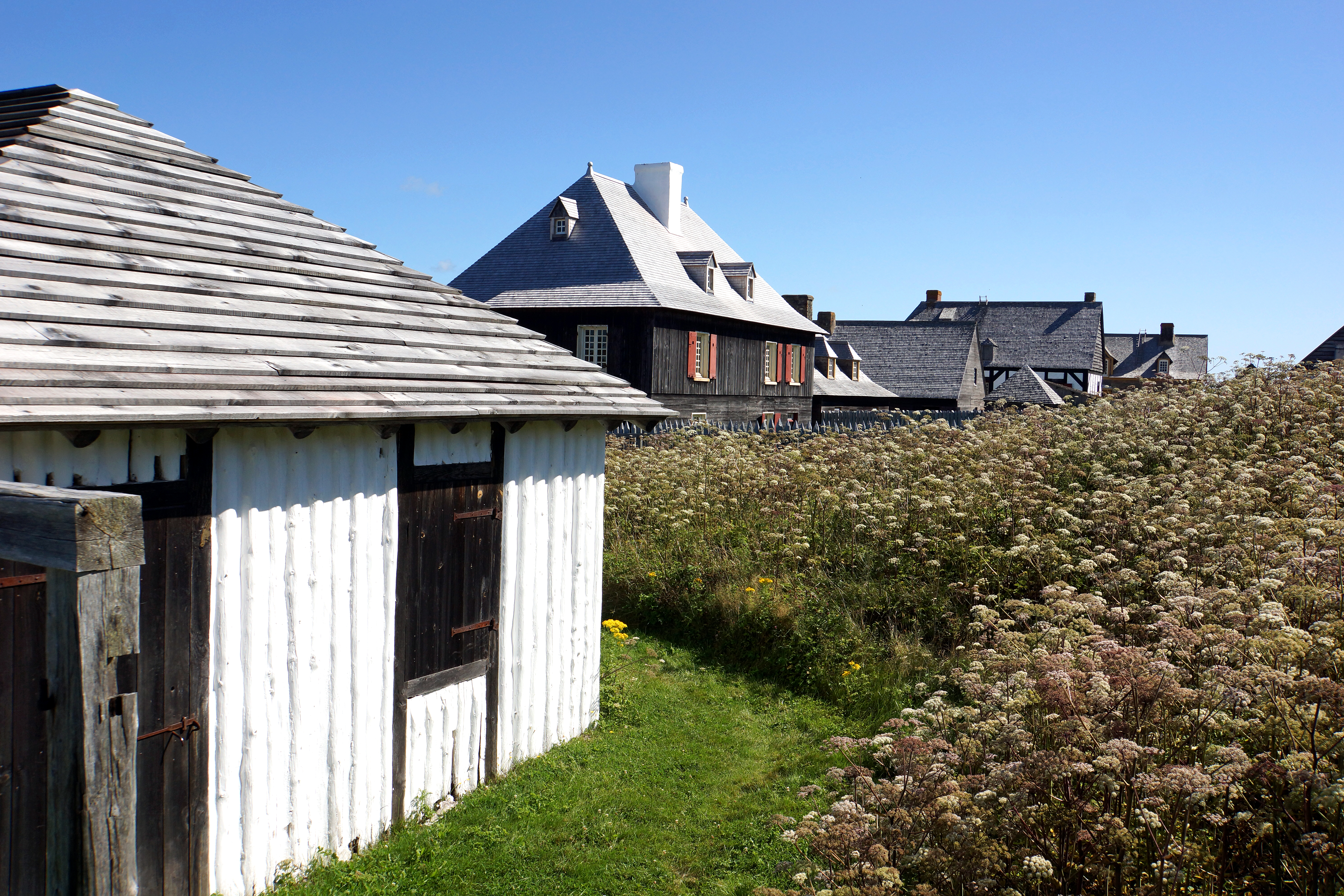
File:Fortress Louisbourg DSC02309 - Duhaget House (red shutters) (8176241441).jpg
Original file (6,000 × 4,000 pixels, file size: 20.19 MB, MIME type: image/jpeg)
Captions
Captions
Summary
edit_(8176241441).jpg&action=edit§ion=1)
| Description |
English: PLEASE, no multi invitations or self promotion in your comments, THEY WILL BE DELETED. My photos are FREE for anyone to use, just give me credit and it would be nice if you let me know, thanks - NONE OF MY PICTURES ARE HDR.
This is the street behind the King's Bakery. The lady is beside the Laundry and Stables (left) and the Duhaget House on the right Robert Tarride Duhaget began his military service in France. By 1723 he was in Île Royale (Cape Breton) where he was made second ensign and 5 years later ensign. Posted to Île Saint-Jean (Prince Edward Island) in 1729 he assumed control of the garrison there when its commander became ill. In 1730 Duhaget became a lieutenant. From 1731 he served at Louisbourg, then returned to Île Saint-Jean in 1736 as interim commander. In 1739 he was promoted to full captain, with his own company. He led his company in defence of the Queen’s bastion during the siege of Louisbourg in 1745. After the fall of the fortress he was sent to France with the rest of the Île Royale garrison. Early in 1748 he was admitted to the order of Saint-Louis. After the treaty of Aix-la-Chapelle, the island was restored to France in 1748. Duhaget returned to Île Royale as commander of Port-Toulouse (St Peters) in 1749. In 1750 a mutiny happened, brought on by an altercation between a corporal and the garrison cook about poor food. Duhaget was wounded and had to return to France for treatment. Not fully recovered he returned to Île Royale in 1751. On 11 July 1753 Duhaget was made major of Louisbourg, he held the post until the autumn of 1757. Because of declining health, he returned to France where he died soon afterwards. |
| Date | |
| Source | DSC02309 - Duhaget House (red shutters) |
| Author | Dennis Jarvis from Halifax, Canada |
| Permission (Reusing this file) |
Quote from photographer on numerous files
|
| Camera location | | View this and other nearby images on: OpenStreetMap |
|---|
_(8176241441).jpg¶ms=045.894488_N_-059.985094_E_globe:Earth_type:camera_source:Flickr_&language=en)
Licensing
edit_(8176241441).jpg&action=edit§ion=2)
- You are free:
- to share – to copy, distribute and transmit the work
- to remix – to adapt the work
- Under the following conditions:
- attribution – You must give appropriate credit, provide a link to the license, and indicate if changes were made. You may do so in any reasonable manner, but not in any way that suggests the licensor endorses you or your use.
- share alike – If you remix, transform, or build upon the material, you must distribute your contributions under the same or compatible license as the original.
| This image was originally posted to Flickr by archer10 (Dennis) 117M Views at https://flickr.com/photos/22490717@N02/8176241441 (archive). It was reviewed on 3 March 2018 by FlickreviewR 2 and was confirmed to be licensed under the terms of the cc-by-sa-2.0. |
File history
Click on a date/time to view the file as it appeared at that time.
| Date/Time | Thumbnail | Dimensions | User | Comment | |
|---|---|---|---|---|---|
| current | 14:15, 3 March 2018 | | 6,000 × 4,000 (20.19 MB) | Artix Kreiger 2 (talk | contribs) | Transferred from Flickr via Flickr2Commons |
You cannot overwrite this file.
File usage on Commons
The following page uses this file:
_(8176241441).jpg&redirect=no)
_(8176241441).jpg&oldid=808664369)