File:Fortress Louisbourg DSC02471 - The Engineer’s Property (8176719289).jpg

Original file (6,028 × 4,042 pixels, file size: 21.63 MB, MIME type: image/jpeg)
Captions
Captions
Summary
edit.jpg&action=edit§ion=1)
| Description |
English: PLEASE, no multi invitations or self promotion in your comments, THEY WILL BE DELETED. My photos are FREE for anyone to use, just give me credit and it would be nice if you let me know, thanks .
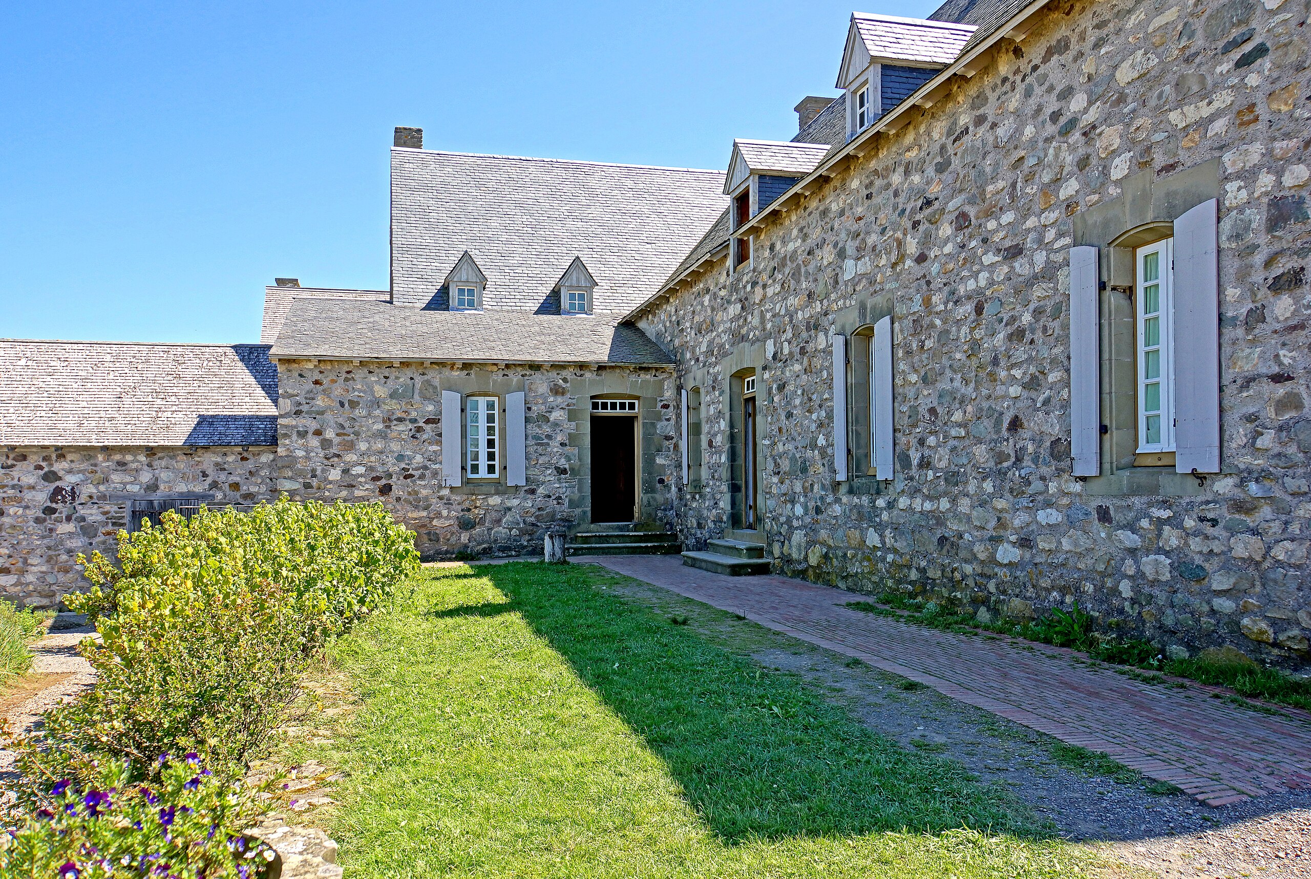
This stately house was one of Louisbourg’s most imposing homes. The military engineers who lived and worked here were town planners, architects and construction engineers all in one – their influence pervades the town. The royal engineers laid out the streets and blocks, planned the fortifications and outlying works, and designed all the colony’s public buildings. Consulted on all scientific and technical issues, they even influenced military tactics in the sieges. Etienne Verrier (1683-1747) was chief engineer here from 1725 to 1745. For most of those years his wife and daughter remained in France, and Verrier sometimes spent the winter there. The two sons who had accompanied him here assisted his work, so the air of the residence is masculine and professional, except in the kitchen where the cooking creates a warmer atmosphere. The garden is formal, combining vegetable beds, herbs and some flowers in geometric patterns and varied shades of green. Not every garden was so elaborate, but each was appreciated for the fresh food it added to a dried and salted diet. Beyond the garden are a laundry and stables and a poultry yard. Etienne Verrier was criticized for his siege craft and he vastly overspent his estimates to build his house, but if you appreciate the aesthetic flair of Louisbourg and its public architecture, give the designer his due. |
| Date | |
| Source | DSC02471 - The Engineer’s Property |
| Author | Dennis Jarvis from Halifax, Canada |
| Permission (Reusing this file) |
Quote from photographer on numerous files
|
| Camera location | | View this and other nearby images on: OpenStreetMap |
|---|
.jpg¶ms=045.894488_N_-059.985094_E_globe:Earth_type:camera_source:Flickr_&language=en)
Licensing
edit.jpg&action=edit§ion=2)
- You are free:
- to share – to copy, distribute and transmit the work
- to remix – to adapt the work
- Under the following conditions:
- attribution – You must give appropriate credit, provide a link to the license, and indicate if changes were made. You may do so in any reasonable manner, but not in any way that suggests the licensor endorses you or your use.
- share alike – If you remix, transform, or build upon the material, you must distribute your contributions under the same or compatible license as the original.
| This image was originally posted to Flickr by archer10 (Dennis) 117M Views at https://flickr.com/photos/22490717@N02/8176719289 (archive). It was reviewed on 3 March 2018 by FlickreviewR 2 and was confirmed to be licensed under the terms of the cc-by-sa-2.0. |
File history
Click on a date/time to view the file as it appeared at that time.
| Date/Time | Thumbnail | Dimensions | User | Comment | |
|---|---|---|---|---|---|
| current | 14:08, 3 March 2018 | | 6,028 × 4,042 (21.63 MB) | Artix Kreiger 2 (talk | contribs) | Transferred from Flickr via Flickr2Commons |
You cannot overwrite this file.
File usage on Commons
The following 2 pages use this file:
.jpg&redirect=no)
.jpg&redirect=no)
.jpg&oldid=808664471)