File:Fourth and Arthur, Gary.jpg

Size of this preview: 800 × 450 pixels. Other resolutions: 320 × 180 pixels | 640 × 360 pixels | 1,024 × 576 pixels | 1,280 × 720 pixels | 2,816 × 1,584 pixels.
Original file (2,816 × 1,584 pixels, file size: 974 KB, MIME type: image/jpeg)
Captions
Captions
Add a one-line explanation of what this file represents
| Camera location | | View this and other nearby images on: OpenStreetMap |
|---|
| Description |
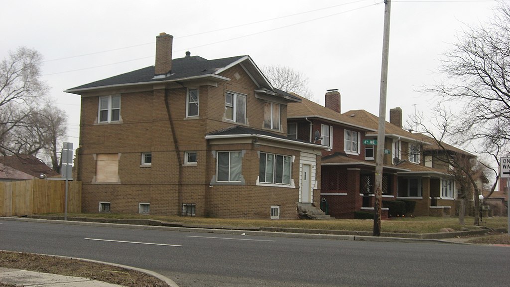
English: Houses on the western side of Arthur Street south of the Fourth Avenue (U.S. Routes 12/20) intersection in Gary, Indiana, United States. This neighborhood is part of the Eskilson Historic District, a historic district that is listed on the National Register of Historic Places.
|
||
| Date | Taken on 29 March 2014 | ||
| Source | Own work | ||
| Author | Nyttend | ||
| Permission (Reusing this file) |
|
File history
Click on a date/time to view the file as it appeared at that time.
| Date/Time | Thumbnail | Dimensions | User | Comment | |
|---|---|---|---|---|---|
| current | 03:29, 11 April 2014 | | 2,816 × 1,584 (974 KB) | Nyttend (talk | contribs) | {{Location|41|36|13|N|87|21|37|W}} {{Information |Description={{en|Houses on the western side of Arthur Street south of the Fourth Avenue (U.S. Routes {{w|U.S. Route 12|12}}/{{w|U.S. Route 20|20}}) intersection in {{w|Gary, Indiana|Gary}}, {{w|Indiana}... |
You cannot overwrite this file.
File usage on Commons
The following page uses this file:
File usage on other wikis
The following other wikis use this file:
- Usage on en.wikipedia.org
- Usage on www.wikidata.org