File:France-000539 - Eiffel Tower & Carousel (Last of Paris) (14707800167).jpg

Original file (4,523 × 6,349 pixels, file size: 17.25 MB, MIME type: image/jpeg)
Captions
Captions
Summary edit
_(14707800167).jpg&action=edit§ion=1)
| Description |
English: PLEASE, NO invitations or self promotions, THEY WILL BE DELETED. My photos are FREE to use, just give me credit and it would be nice if you let me know, thanks.
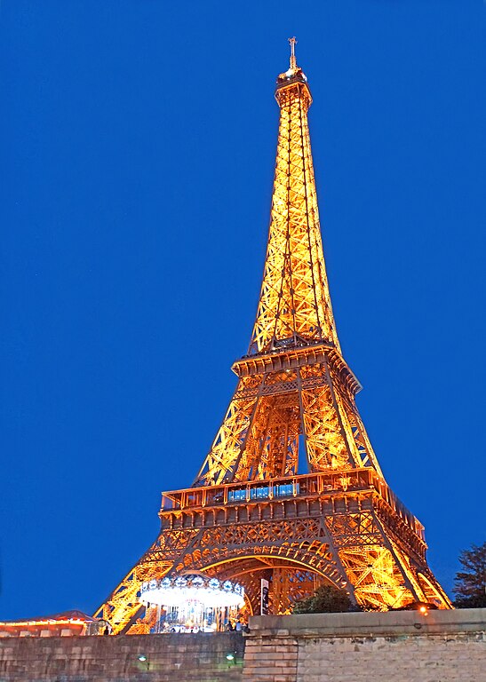
At the end of the cruise the Eiffel Tower was just lighting up. The Eiffel Tower was named after the engineer Gustave Eiffel, whose company designed and built the tower. Erected in 1889 as the entrance arch to the 1889 World's Fair, it was initially criticised by some artists and intellectuals, but it has become one of the most recognizable structures in the world. The tower is the tallest structure in Paris and the most visited paid monument in the world. The tower is 324 metres (1,063 ft) tall, about the same height as an 81-storey building. It was tallest man-made structure in the world, a title it held for 41 years when it was built. The tower has three levels for visitors, with restaurants on the first and second. The third level observatory's upper platform is 276 m (906 ft) above the ground, the highest accessible to the public in the European Union. |
| Date | |
| Source | France-000539 - Eiffel Tower & Carousel (Last of Paris) |
| Author | Dennis Jarvis from Halifax, Canada |
| Permission (Reusing this file) |
Quote from photographer on numerous files
Quote from photographer on numerous files
|
| Camera location | | View this and other nearby images on: OpenStreetMap |
|---|
_(14707800167).jpg¶ms=048.864714_N_0002.331848_E_globe:Earth_type:camera_source:Flickr_&language=en)
Licensing edit
_(14707800167).jpg&action=edit§ion=2)
- You are free:
- to share – to copy, distribute and transmit the work
- to remix – to adapt the work
- Under the following conditions:
- attribution – You must give appropriate credit, provide a link to the license, and indicate if changes were made. You may do so in any reasonable manner, but not in any way that suggests the licensor endorses you or your use.
- share alike – If you remix, transform, or build upon the material, you must distribute your contributions under the same or compatible license as the original.
| This image was originally posted to Flickr by archer10 (Dennis) 117M Views at https://flickr.com/photos/22490717@N02/14707800167 (archive). It was reviewed on 2 March 2018 by FlickreviewR 2 and was confirmed to be licensed under the terms of the cc-by-sa-2.0. |
File history
Click on a date/time to view the file as it appeared at that time.
| Date/Time | Thumbnail | Dimensions | User | Comment | |
|---|---|---|---|---|---|
| current | 13:49, 2 March 2018 | | 4,523 × 6,349 (17.25 MB) | Artix Kreiger 2 (talk | contribs) | Transferred from Flickr via Flickr2Commons |
You cannot overwrite this file.
File usage on Commons
The following page uses this file:
_(14707800167).jpg&oldid=652369790)