File:France 1800.jpg

Size of this preview: 643 × 600 pixels. Other resolutions: 257 × 240 pixels | 515 × 480 pixels | 824 × 768 pixels | 1,098 × 1,024 pixels | 2,000 × 1,865 pixels.
Original file (2,000 × 1,865 pixels, file size: 3.9 MB, MIME type: image/jpeg)
Captions
Captions
Add a one-line explanation of what this file represents
Summary
edit
| Description |
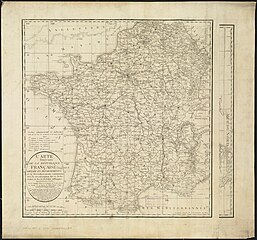
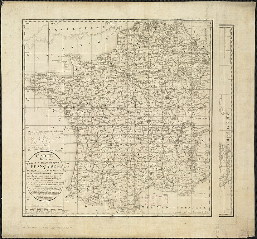
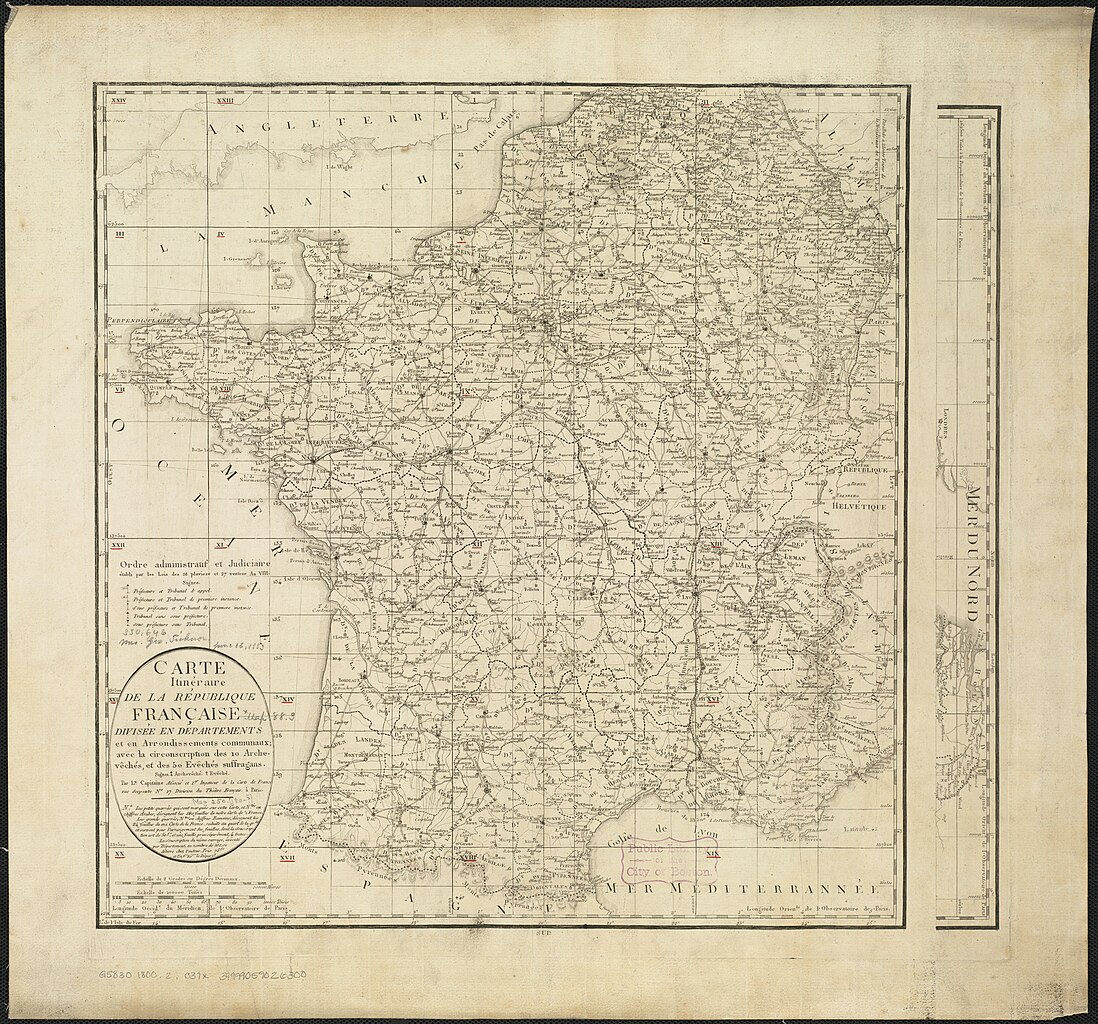
Zoom into this map at maps.bpl.org. Author: Capitaine, Louis Date: 1800 Location: France Dimension 49x51cm Scale: ca. 2,100,000 Call Number: G5830 1800.2 .C37x |
| Date | |
| Source | Carte itinéraire de la Républic Française divisée en departments et en arrondissements communaux, avec la circonscription des 10 archevêchés, et des 50 evêchés suffragans |
| Author | http://maps.bpl.org |
Licensing
edit
This file is licensed under the Creative Commons Attribution 2.0 Generic license.
- You are free:
- to share – to copy, distribute and transmit the work
- to remix – to adapt the work
- Under the following conditions:
- attribution – You must give appropriate credit, provide a link to the license, and indicate if changes were made. You may do so in any reasonable manner, but not in any way that suggests the licensor endorses you or your use.
| This image was originally posted to Flickr by Norman B. Leventhal Map Center at the BPL at https://www.flickr.com/photos/24528911@N05/4586561833. It was reviewed on 11 May 2010 by FlickreviewR and was confirmed to be licensed under the terms of the cc-by-2.0. |
File history
Click on a date/time to view the file as it appeared at that time.
| Date/Time | Thumbnail | Dimensions | User | Comment | |
|---|---|---|---|---|---|
| current | 14:57, 11 May 2010 | | 2,000 × 1,865 (3.9 MB) | Dr Brains (talk | contribs) | {{Information |Description=Zoom into [http://maps.bpl.org/id/14342 this map] at [http://maps.bpl.org maps.bpl.org]. Author: Capitaine, Louis Date: 1800 Location: France Dimension 49x51cm Scale: ca. 2,100,000 Call Number: G5830 1800.2 .C37x |Source=[ht |
You cannot overwrite this file.
File usage on Commons
The following 2 pages use this file:
File usage on other wikis
The following other wikis use this file:
- Usage on et.wikipedia.org
- Usage on si.wikipedia.org