File:France A29.svg

Size of this PNG preview of this SVG file: 400 × 200 pixels. Other resolutions: 320 × 160 pixels | 640 × 320 pixels | 1,024 × 512 pixels | 1,280 × 640 pixels | 2,560 × 1,280 pixels.
Original file (SVG file, nominally 400 × 200 pixels, file size: 43 KB)
Captions
Captions
Add a one-line explanation of what this file represents
Summary
edit

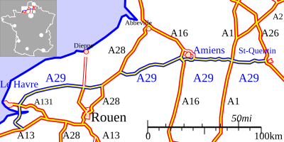
French motorway / l’autoroute française A29, part of the Grand Contournement of Paris (image on right).
The agglomerations on the locator map (from North to South): Lille, Paris, Nantes, Lyon, Bordeaux, Toulouse and Marseille.
| Description |
English: French motorway A29. |
| Date | |
| Source | Plotted by a program written by the Author |
| Author | Eurocommuter |
| Permission (Reusing this file) |
See licence tag |
Licensing
edit
I, the copyright holder of this work, hereby publish it under the following licenses:
This file is licensed under the Creative Commons Attribution-Share Alike 3.0 Unported license.
- You are free:
- to share – to copy, distribute and transmit the work
- to remix – to adapt the work
- Under the following conditions:
- attribution – You must give appropriate credit, provide a link to the license, and indicate if changes were made. You may do so in any reasonable manner, but not in any way that suggests the licensor endorses you or your use.
- share alike – If you remix, transform, or build upon the material, you must distribute your contributions under the same or compatible license as the original.

|
Permission is granted to copy, distribute and/or modify this document under the terms of the GNU Free Documentation License, Version 1.2 or any later version published by the Free Software Foundation; with no Invariant Sections, no Front-Cover Texts, and no Back-Cover Texts. A copy of the license is included in the section entitled GNU Free Documentation License. |
You may select the license of your choice.
File history
Click on a date/time to view the file as it appeared at that time.
| Date/Time | Thumbnail | Dimensions | User | Comment | |
|---|---|---|---|---|---|
| current | 17:01, 5 October 2008 | | 400 × 200 (43 KB) | Eurocommuter~commonswiki (talk | contribs) | {{Information |Description={{en|1=French motorway A29.}} |Source=Own work by uploader |Author=Eurocommuter |Date=5 Oct, 2008 |Permission= |other_versions= }} <!--{{ImageUpload|full}}--> Category:Road maps of France |
You cannot overwrite this file.
File usage on Commons
The following page uses this file:
File usage on other wikis
The following other wikis use this file:
- Usage on de.wikipedia.org
- Usage on en.wikipedia.org
- Usage on fr.wikipedia.org
- Usage on it.wikipedia.org
- Usage on zh.wikipedia.org