File:Franklin Square, W14 - geograph.org.uk - 1443866.jpg
No higher resolution available.
Franklin_Square,_W14_-_geograph.org.uk_-_1443866.jpg (640 × 427 pixels, file size: 55 KB, MIME type: image/jpeg)
Captions
Captions
Add a one-line explanation of what this file represents
Summary edit
| Description |
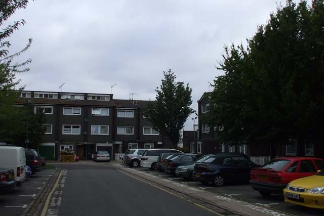
English: Franklin Square, W14 Although technically a square, only these 2 sides shown are covered with housing. The central communal area is rather than a garden a surface level car park with some trees. This speaks volumes about local planning and developers' priorities but also reflects a continued need or economic quasi-necessity in the area for cars or vans. Alternatively an underground car park could be built in the manner of Finsbury Square, which requires investment and an appreciation of the aesthetic and anti-pollution qualities of an urban garden. The W14 end of the borough, an broad area of dry, gravelly land has since 1945 housed workers on lower incomes than the southern end in and at the start of a long bend in the Thames (central Hammersmith and all of Fulham). |
| Date | |
| Source | From geograph.org.uk |
| Author | Phillip Perry |
| Attribution (required by the license) | Phillip Perry / Franklin Square, W14 / |
| Camera location | | View this and other nearby images on: OpenStreetMap |
|---|
_heading:337.00&language=en)
| Object location | | View this and other nearby images on: OpenStreetMap |
|---|
_heading:337.00&language=en)
Licensing edit

|
This image was taken from the Geograph project collection. See this photograph's page on the Geograph website for the photographer's contact details. The copyright on this image is owned by Phillip Perry and is licensed for reuse under the Creative Commons Attribution-ShareAlike 2.0 license.
|
This file is licensed under the Creative Commons Attribution-Share Alike 2.0 Generic license.
Attribution: Phillip Perry
- You are free:
- to share – to copy, distribute and transmit the work
- to remix – to adapt the work
- Under the following conditions:
- attribution – You must give appropriate credit, provide a link to the license, and indicate if changes were made. You may do so in any reasonable manner, but not in any way that suggests the licensor endorses you or your use.
- share alike – If you remix, transform, or build upon the material, you must distribute your contributions under the same or compatible license as the original.
File history
Click on a date/time to view the file as it appeared at that time.
| Date/Time | Thumbnail | Dimensions | User | Comment | |
|---|---|---|---|---|---|
| current | 02:03, 2 March 2011 | | 640 × 427 (55 KB) | GeographBot (talk | contribs) | == {{int:filedesc}} == {{Information |description={{en|1=Franklin Square, W14 Although technically a square, only these 2 sides shown are covered with housing.}} |date=2009-08-15 |source=From [http://www.geograph.org.uk/photo/1443866 geograph.org.uk] |au |
You cannot overwrite this file.
File usage on Commons
There are no pages that use this file.
File usage on other wikis
The following other wikis use this file:
- Usage on en.wikipedia.org