File:Freeden Hermannsweg 003.jpg

Size of this preview: 335 × 599 pixels. Other resolutions: 134 × 240 pixels | 268 × 480 pixels | 429 × 768 pixels | 572 × 1,024 pixels | 1,145 × 2,048 pixels | 2,888 × 5,164 pixels.
Original file (2,888 × 5,164 pixels, file size: 11.78 MB, MIME type: image/jpeg)
Captions
Captions
Add a one-line explanation of what this file represents
Summary
edit
| Description |
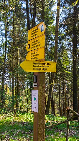
English: Fingerpost at the Ridgeway (Kammweg) through the Freeden. This footpath forms part of the well known hiking trail Hermannsweg. The Freeden itself is a mountain and forest near Bad Iburg, Landkreis Osnabrück, Lower Saxony, Germany.
Deutsch: Wegweiser am Kammweg im Freeden. Der auch für Radfahrer zugelassene Fußweg ist auch Teil des bekannten Wanderwegs Hermannsweg. Der Freeden seinerseits ist zugleich ein Berg und Waldgebiet bei Bad Iburg, Landkreis Osnabrück, Niedersachsen, Deutschland. |
| Date | |
| Source | Own work |
| Author | J.-H. Janßen |
| Camera location | | View this and other nearby images on: OpenStreetMap |
|---|
Licensing
edit
I, the copyright holder of this work, hereby publish it under the following license:
| This file is made available under the Creative Commons CC0 1.0 Universal Public Domain Dedication. | |
| The person who associated a work with this deed has dedicated the work to the public domain by waiving all of their rights to the work worldwide under copyright law, including all related and neighboring rights, to the extent allowed by law. You can copy, modify, distribute and perform the work, even for commercial purposes, all without asking permission.
|
File history
Click on a date/time to view the file as it appeared at that time.
| Date/Time | Thumbnail | Dimensions | User | Comment | |
|---|---|---|---|---|---|
| current | 11:48, 1 May 2017 | | 2,888 × 5,164 (11.78 MB) | J.-H. Janßen (talk | contribs) | {{Information |Description ={{en|1=The ''Ridgeway'' (''Kammweg'') through the ''Freeden''. This footpath forms part of the well known hiking trail ''Hermannsweg''. The ''Freeden'' itself is a mountain and forest near Bad Iburg, [[Landkreis Osnabrü... |
You cannot overwrite this file.
File usage on Commons
There are no pages that use this file.