File:Fries worldmap 1522.jpg

Size of this preview: 800 × 584 pixels. Other resolutions: 320 × 234 pixels | 640 × 467 pixels | 1,024 × 748 pixels | 1,280 × 934 pixels | 2,560 × 1,869 pixels | 3,000 × 2,190 pixels.
Original file (3,000 × 2,190 pixels, file size: 3.83 MB, MIME type: image/jpeg)
Captions
Captions
Add a one-line explanation of what this file represents
Summary edit
| Artist | |
| Author |
Ptolemy, translated by Willibald Pirckheimer |
| Description |
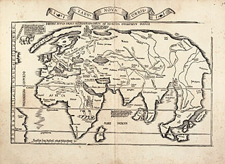
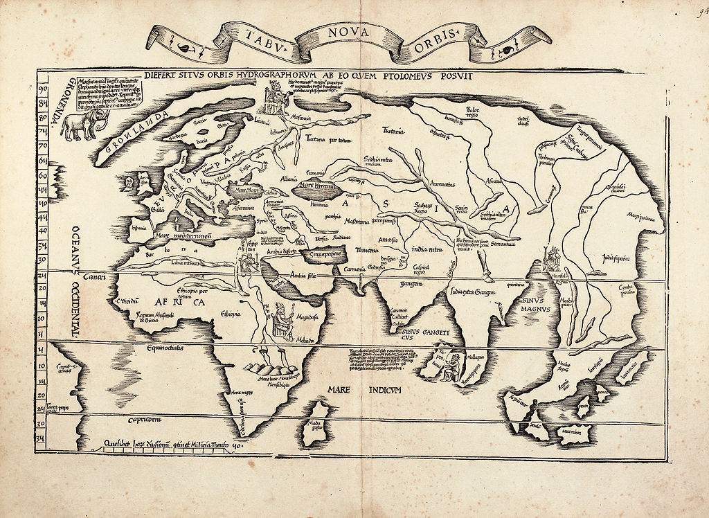
English: A New World Map (Tabu. Nova Orbis) by Laurent Fries, one of the two modern world maps of the 1522 Strassburg edition of Ptolemy's 'Geography'; largely based on a 1513 map by Martin Waldseemüller.
Deutsch: Weltkarte des Laurent Fries, basierend auf der Waldseemüller Karte von 1513. |
| Date | 1522 |
| Source/Photographer | http://www.vintage-map.com/en/Antique-Maps/World-Maps/Fries-World-Maps-1535::833.html |
| Other versions |
|


Licensing edit
|
This work is in the public domain in its country of origin and other countries and areas where the copyright term is the author's life plus 100 years or fewer. | |
| This file has been identified as being free of known restrictions under copyright law, including all related and neighboring rights. | |
File history
Click on a date/time to view the file as it appeared at that time.
| Date/Time | Thumbnail | Dimensions | User | Comment | |
|---|---|---|---|---|---|
| current | 08:55, 21 January 2010 | | 3,000 × 2,190 (3.83 MB) | Ray007 (talk | contribs) | {{Information |Description={{en|1=World map of Laurent Fries, based on the Waldseemüller map of 1513.}} {{de|1=Weltkarte des Laurent Fries, basierend auf der Waldseemüller Karte von 1513.}} |Source=http://www.vintage-map.com/en/Antique-Maps/World-Maps/F |
You cannot overwrite this file.
File usage on Commons
The following 8 pages use this file:
- Old maps
- File:Claudius Ptolemaeus - Geographicae enarrationis libri octo.jpg
- File:Diefert Situs Orbis Hydrographorum ab Eo quem Ptolomeus Posuit.jpg
- File:Fries worldmap 1522.jpg
- File:Orbis Typus Universalis Iuxta Hydrographorum Traditionem.jpg
- File:Orbis Typus Universalis iuxta Hydrographorum Traditionem Exactissime Depicta 1522 LF.jpg
- File:Orbis Typus Universalis iuxta Hydrographorum Traditionem Exactissime Depicta 1522 L F.jpg
- File:Orbis typus uniuersalis iuxta hydrographorum traditionem - Norman B. Leventhal Map Center at the BPL.jpg
File usage on other wikis
The following other wikis use this file:
- Usage on de.wikipedia.org
- Usage on en.wikipedia.org
- Usage on it.wikipedia.org
- Usage on ja.wikipedia.org
- Usage on lt.wikipedia.org
- Usage on no.wikipedia.org
- Usage on ro.wikipedia.org