File:Frisiae, about 1600, by Ubbo Emmius.jpg
Original file (2,878 × 2,225 pixels, file size: 1.71 MB, MIME type: image/jpeg)
Captions
Captions
Summary
edit| Description |
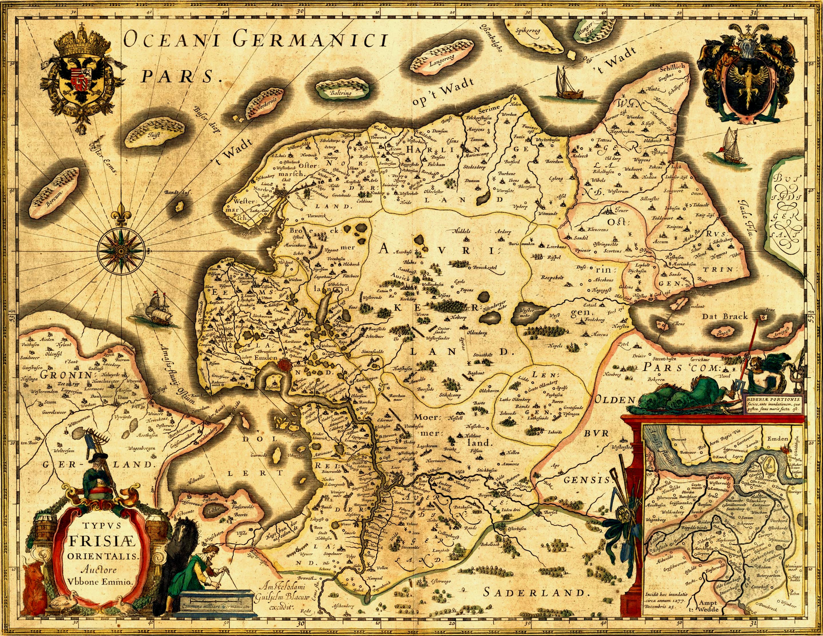
Deutsch: Alte Karte von Ostfriesland. English: Old map of East Frisia. Plattdüütsch: aulte landkoort vun Oostfreesland Español: mapa antigua de Frisia oriental |
|||||||||||||||||||||||
| Date | circa 1600 | |||||||||||||||||||||||
| Source | http://www.library.ucla.edu/yrl/reference/maps/blaeu/frisiae.jpg (deprecated link) | |||||||||||||||||||||||
| Creator |
|
|||||||||||||||||||||||
| Permission (Reusing this file) |
public domain because of age | |||||||||||||||||||||||
| Georeferencing | ||||||||||||||||||||||||
| Other versions |

Note: The colors may be adjusted again in the future. I did it on a TFT. ^.^ A 500dpi TIFF version can be ordered here: http://www.library.ucla.edu/yrl/reference/maps/blaeu/germania.htm (deprecated link) |
|||||||||||||||||||||||
.jpg)
|
This work is in the public domain in its country of origin and other countries and areas where the copyright term is the author's life plus 70 years or fewer.
| |
| This file has been identified as being free of known restrictions under copyright law, including all related and neighboring rights. | |
File history
Click on a date/time to view the file as it appeared at that time.
| Date/Time | Thumbnail | Dimensions | User | Comment | |
|---|---|---|---|---|---|
| current | 22:03, 16 January 2007 | | 2,878 × 2,225 (1.71 MB) | Enricopedia (talk | contribs) | {{Information |Description= {{de|Alte Karte von Ostfriesland.}}{{en|Old map of East Frisia.}} |Source= http://www.library.ucla.edu/yrl/reference/maps/blaeu/frisiae.jpg |Date=14th century |Author=[[:de:Ubbo Emmius|Ub |
You cannot overwrite this file.
File usage on Commons
The following 11 pages use this file:
.jpg)
.jpg)
File usage on other wikis
The following other wikis use this file:
- Usage on azb.wikipedia.org
- Usage on da.wikipedia.org
- Usage on de.wikipedia.org
- 1600
- Jadebusen
- Ostfriesland
- Dollart
- Norderney
- Cirksena
- Norden (Ostfriesland)
- Wittmund
- Bockhorn (Friesland)
- Arngast
- Sande (Friesland)
- Rüstringen
- Leybucht
- Harlebucht
- Geschichte Ostfrieslands
- Heppens
- Schwarzes Brack
- Neustadtgödens
- Auricherland
- Wikipedia:WikiProjekt Ostfriesland/Kartenzimmer
- Diskussion:Ostfriesland/Archiv/1
- Grafschaft Ostfriesland
- Steinhaus Bunderhee
- Antoniflut
- Diskussion:Norderney/Archiv/1
- Ostfriesland zur Zeit des Dreißigjährigen Krieges
- Wikipedia Diskussion:Hauptseite/Artikel des Tages/Archiv/Vorschläge/2010/1
- Wikipedia Diskussion:Hauptseite/Archiv/2010/Januar
- Portal:Ostfriesland/Ausgezeichnet
- Portal:Ostfriesland/EA
- Itzendorf
- Mariensiel
- Wikipedia Diskussion:WikiProjekt Ostfriesland/Archiv/2010
- Bucht von Sielmönken
- Maadebucht
- Herrlichkeit Gödens
- Crildumer Bucht
- Ellenser Damm
- Wikipedia Diskussion:Hauptseite/Artikel des Tages/Archiv/Vorschläge/2014/Q2
- Wikipedia:Hauptseite/Archiv/20. April 2014
- Hilgenrieder Bucht
- Vorlage:Navigationsleiste Meeresbuchten und ehemalige Meeresbuchten auf der Ostfriesischen Halbinsel
- Benutzer:GregorHelms/Falstertief
- Usage on de.wikisource.org
- Usage on en.wikipedia.org
View more global usage of this file.