File:Ft. Lyon sector map.tif

Size of this JPG preview of this TIF file: 403 × 599 pixels. Other resolutions: 161 × 240 pixels | 636 × 945 pixels.
Original file (636 × 945 pixels, file size: 1.73 MB, MIME type: image/tiff)
Captions
Captions
Add a one-line explanation of what this file represents
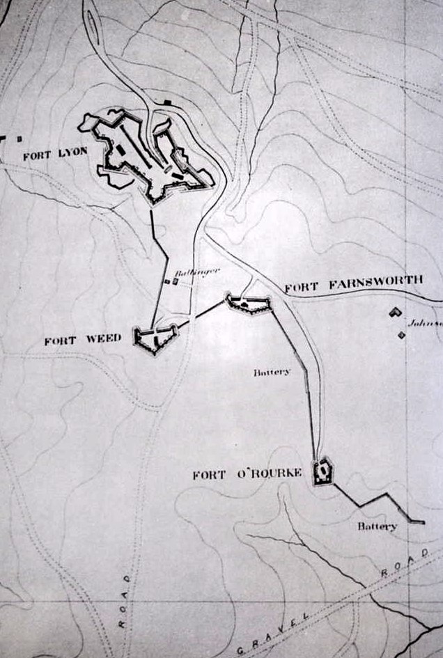
| Description | Map of the Defenses of Washington between Ft. Lyon and Ft. O'Rourke | |||
| Date | circa 1865 | |||
| Source | Cooling III, Benjamin Franklin & Owen II, Walton H. (1988). Mr. Lincoln's Forts: A Guide to the Civil War Defenses of Washington. Shippensburg, Pennsylvania: White Mane Publishing. ISBN 0-942597-06-0. p. 54 | |||
| Author | Unknown US Army engineer | |||
| Permission (Reusing this file) |
|

File history
Click on a date/time to view the file as it appeared at that time.
| Date/Time | Thumbnail | Dimensions | User | Comment | |
|---|---|---|---|---|---|
| current | 22:31, 5 January 2018 |  | 636 × 945 (1.73 MB) | Sturmvogel 66 (talk | contribs) | {{Information |Description=Map of the Defenses of Washington between Ft. Lyon and Ft. O'Rourke |Source=Cooling III, Benjamin Franklin & Owen II, Walton H. (1988). Mr. Lincoln's Forts: A Guide to the Civil War Defenses of Washington. Shippensburg, Penns... |
You cannot overwrite this file.
File usage on Commons
There are no pages that use this file.
File usage on other wikis
The following other wikis use this file:
- Usage on en.wikipedia.org