File:Fukaya Communication Site area Aerial photograph 2007.jpg

Size of this preview: 600 × 600 pixels. Other resolutions: 240 × 240 pixels | 480 × 480 pixels | 768 × 768 pixels | 1,024 × 1,024 pixels | 2,048 × 2,048 pixels | 3,000 × 3,000 pixels.
Original file (3,000 × 3,000 pixels, file size: 10.14 MB, MIME type: image/jpeg)
Captions
Captions
Add a one-line explanation of what this file represents
Summary edit
| Description |
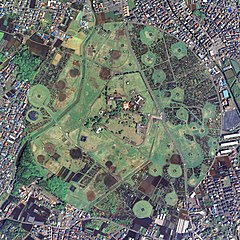
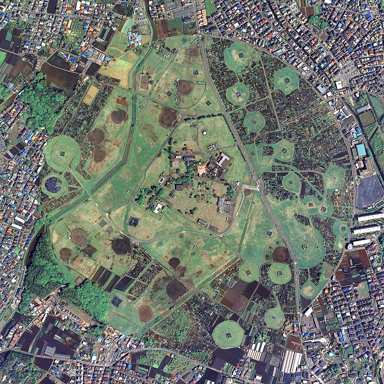
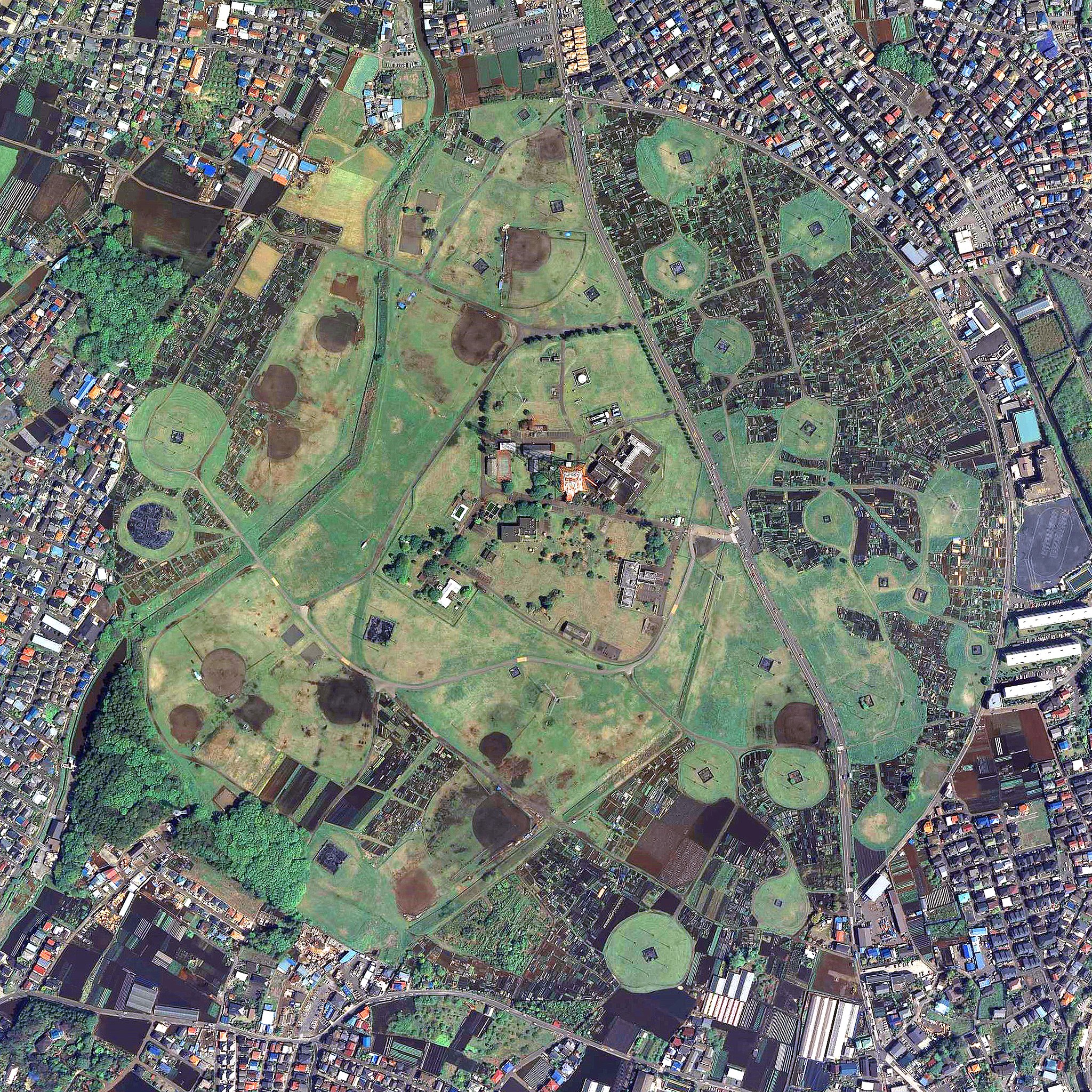
日本語: 神奈川県横浜市泉区にある旧日本海軍の通信施設で、戦後米軍に接収された元・在日米海軍の通信施設の航空写真。国土地理院の航空写真CKT20072-C29-38、CKT20072-C29-39の2枚を合成し、Naokijpが作成。 |
| Date | |
| Source | 国土交通省 国土地理院 地図・空中写真閲覧サービス(https://mapps.gsi.go.jp/maplibSearch.do#1) |
| Author | 国土地理院 |
Licensing edit

|
The copyright holder of this file, the Ministry of Land, Infrastructure, Transport and Tourism of Japan, allows anyone to use it for any purpose, provided that the copyright holder is properly attributed. Redistribution, derivative work, commercial use, and all other use is permitted. |
Attribution:
Copyright © National Land Image Information (Color Aerial Photographs), Ministry of Land, Infrastructure, Transport and Tourism
|
 |
This image is copyrighted by the Ministry of Land, Infrastructure, Transport and Tourism of Japan. For terms of use, see the stipulation to use of National Land Information (in Japanese) and message from MLIT (in Japanese and English). When you display this image on an article, include the following phrase in the description: "Made based on National Land Image Information (Color Aerial Photographs), Ministry of Land, Infrastructure, Transport and Tourism".
|
File history
Click on a date/time to view the file as it appeared at that time.
| Date/Time | Thumbnail | Dimensions | User | Comment | |
|---|---|---|---|---|---|
| current | 07:58, 26 July 2022 | | 3,000 × 3,000 (10.14 MB) | Naokijp (talk | contribs) | Uploaded a work by 国土地理院 from 国土交通省 国土地理院 地図・空中写真閲覧サービス(https://mapps.gsi.go.jp/maplibSearch.do#1) with UploadWizard |
You cannot overwrite this file.
File usage on Commons
There are no pages that use this file.
File usage on other wikis
The following other wikis use this file:
- Usage on ja.wikipedia.org