File:Fuxerna socken.svg

Size of this PNG preview of this SVG file: 634 × 599 pixels. Other resolutions: 254 × 240 pixels | 508 × 480 pixels | 813 × 768 pixels | 1,083 × 1,024 pixels | 2,167 × 2,048 pixels | 1,918 × 1,813 pixels.
Original file (SVG file, nominally 1,918 × 1,813 pixels, file size: 830 KB)
Captions
Captions
Add a one-line explanation of what this file represents
| Description |
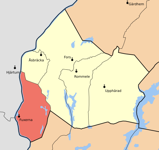
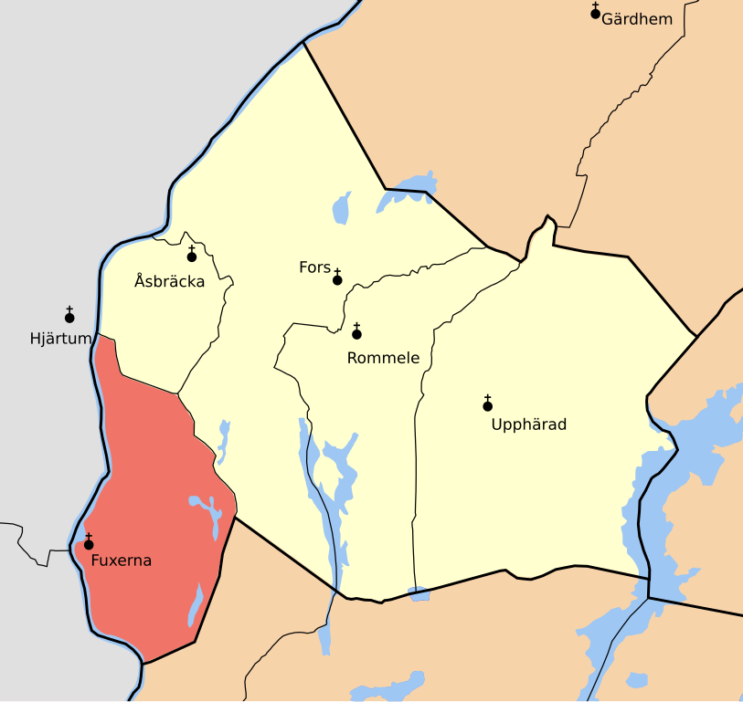
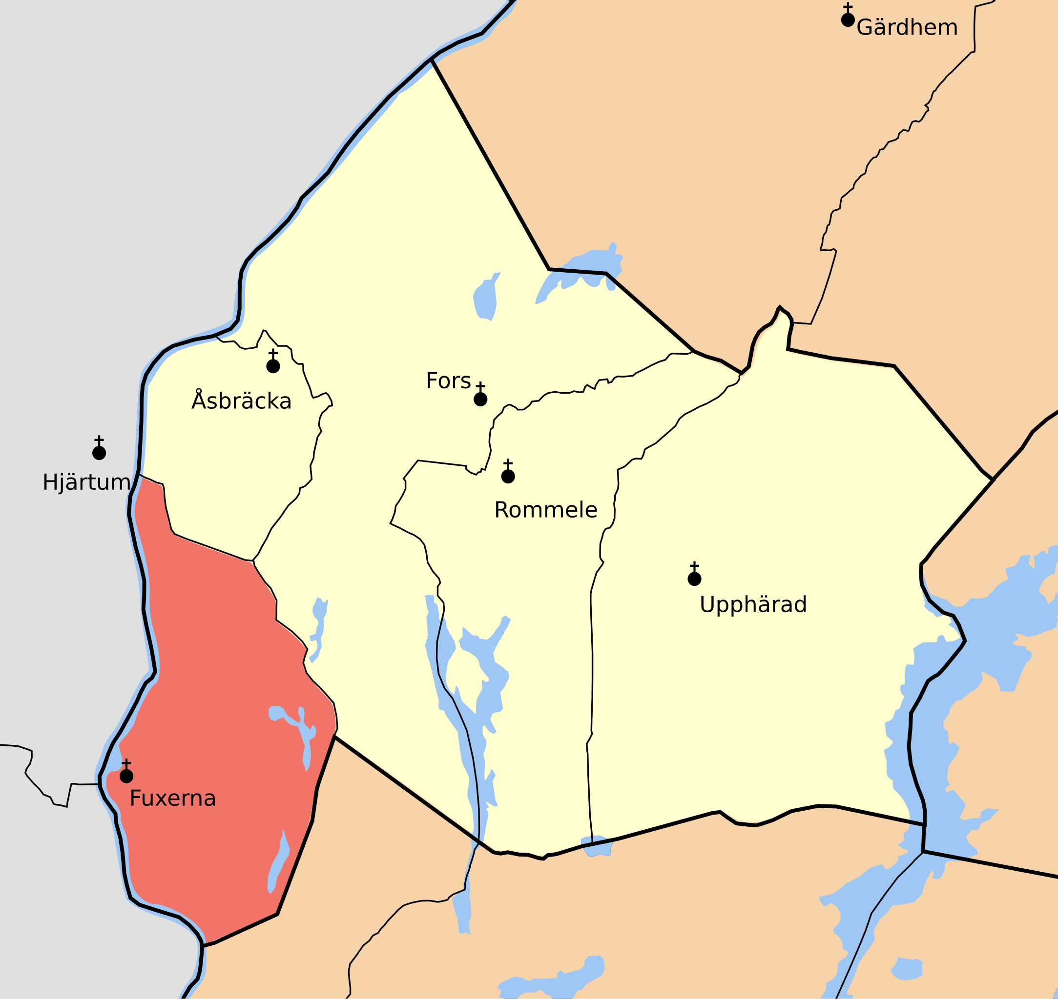
English: Map showing the borders of the civil parish of Fuxerna in the hundred of Flundre, Älvsborg County, Västergötland Region of Sweden. Circa 1850-1900. |
| Date | (1841) |
| Source | Own work based on map by Topografiska kåren, Vänersborg J243-42-1 |
| Author | Edaen |
| Permission (Reusing this file) |
This file is licensed under the Creative Commons Attribution 3.0 Unported license. Attribution: Edaen
|
File history
Click on a date/time to view the file as it appeared at that time.
| Date/Time | Thumbnail | Dimensions | User | Comment | |
|---|---|---|---|---|---|
| current | 18:25, 22 August 2010 | | 1,918 × 1,813 (830 KB) | Edaen (talk | contribs) | Different symbols and colour |
| 13:32, 22 August 2010 |  | 1,919 × 1,813 (845 KB) | Edaen (talk | contribs) | Changes to colour, churchnames don't cross borders &c. | |
| 12:28, 22 August 2010 |  | 1,919 × 1,813 (1,003 KB) | Edaen (talk | contribs) | Added churces, among other things. | |
| 22:05, 21 August 2010 |  | 1,764 × 1,706 (452 KB) | Edaen (talk | contribs) | {{Information |Description={{sv|1=Fuxerna socken i Flundre härad}} |Source={{own}} based on map by ''Topografiska kåren'', Vänersborg J243-42-1 |Author=Edaen |Date=2010-08-21 (1841) |Permission={{cc-by-3.0|Edaen}} |other_versions= }} [[ |
You cannot overwrite this file.
File usage on Commons
The following page uses this file:
File usage on other wikis
The following other wikis use this file:
- Usage on sv.wikipedia.org