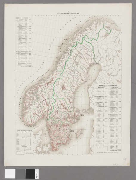
File:Fysisk-geografiska kartor öfver Skandinaviska halfön för beskrifvande undervisning i fäderneslandets geografi - Kungliga Biblioteket - 10372816-thumb.png

Original file (8,896 × 11,702 pixels, file size: 483.93 MB, MIME type: image/png)
Captions
Captions
| Warning | The original file is very high-resolution. It might not load properly or could cause your browser to freeze when opened at full size. |
|---|
| Title |
Fysisk-geografiska kartor öfver Skandinaviska halfön för beskrifvande undervisning i fäderneslandets geografi |
||||||||||||||||||||||||||
| DescriptionFysisk-geografiska kartor öfver Skandinaviska halfön för beskrifvande undervisning i fäderneslandets geografi - Kungliga Biblioteket - 10372816-thumb.png |
Svenska: 1 : Hög- och lågland -- 2 : Höjdförhållanden -- 3 : Vatten-massan -- 4 : Watten-systemerne -- 5 : Växtlighet och klimat -- 6 : Befolkningens utbredning -- 7 : Politiska indelningarne -- 8 : Communicationer |
||||||||||||||||||||||||||
| Source |
|
||||||||||||||||||||||||||
| Creator |
Thure Alexander von Mentzer (1807-1892; creator, cartographer) |
||||||||||||||||||||||||||
| Permission (Reusing this file) |
Per the source the digitisations are under
|
||||||||||||||||||||||||||
| Geotemporal data | |||||||||||||||||||||||||||
| Map location |
Svenska: Skandinavien |
||||||||||||||||||||||||||
| Scale | 1:3,200,000 | ||||||||||||||||||||||||||
| Bounding box |
|
||||||||||||||||||||||||||
| Georeferencing | Georeference the map in Wikimaps Warper If inappropriate please set warp_status = skip to hide. | ||||||||||||||||||||||||||
| Bibliographic data | |||||||||||||||||||||||||||
| Map sheet | 8 kartor på 8 ark | ||||||||||||||||||||||||||
| Language | Swedish | ||||||||||||||||||||||||||
| Publisher |
UnknownUnknown , Stockholm, Sweden |
||||||||||||||||||||||||||
| Archival data | |||||||||||||||||||||||||||
| Collection |
institution QS:P195,Q953058 |
||||||||||||||||||||||||||
| Accession number |
10372816 |
||||||||||||||||||||||||||
| Dimensions | 65 x 52 cm eller mindre | ||||||||||||||||||||||||||
| Medium | färg, litografi | ||||||||||||||||||||||||||
| Notes |
sammandragen af Th. v. Mentzer
|
||||||||||||||||||||||||||
| Other versions |
|
||||||||||||||||||||||||||
File history
Click on a date/time to view the file as it appeared at that time.
| Date/Time | Thumbnail | Dimensions | User | Comment | |
|---|---|---|---|---|---|
| current | 11:59, 21 January 2015 |  | 8,896 × 11,702 (483.93 MB) | L PBot (talk | contribs) | {{subst:User:André_Costa_(WMSE)/KB-map |title = Fysisk-geografiska kartor öfver Skandinaviska halfön för beskrifvande undervisning i fäderneslandets geografi |description = {{sv|1 : Hög- och lågland -- 2 : Höjdförhållanden --... |
You cannot overwrite this file.
File usage on Commons
The following 5 pages use this file:
- User:Josve05a/Sweden/2015 January 21-31
- Commons:Kungliga biblioteket/Reports
- Commons:Kungliga biblioteket/Reports/largest
- Commons:Wikimedia Sverige/recent uploads/2015 January
- File:Fysisk-geografiska kartor öfver Skandinaviska halfön för beskrifvande undervisning i fäderneslandets geografi - Kungliga Biblioteket - 10372816.tif
File usage on other wikis
The following other wikis use this file:
- Usage on en.wikipedia.org
