File:Gózd (gmina) location map.png

Size of this preview: 800 × 445 pixels. Other resolutions: 320 × 178 pixels | 827 × 460 pixels.
Original file (827 × 460 pixels, file size: 135 KB, MIME type: image/png)
Captions
Captions
Add a one-line explanation of what this file represents
| Description |
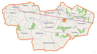
Polski: Mapa gminy Gózd, Polska
English: Map of Gmina Gózd, Poland |
|||||||||
| Date | ||||||||||
| Source | You may find a page on the OpenStreetMap wiki page for Gózd (gmina) | |||||||||
| Creator |
OpenStreetMap contributors OpenStreetMap contributors |
|||||||||
| Permission (Reusing this file) |
OpenStreetMap data is available under the Open Database License (details). Map tiles are licensed under the Creative Commons Attribution-ShareAlike 2.0 license (CC-BY-SA 2.0).
This file is licensed under the Creative Commons Attribution-Share Alike 2.0 Generic license.
|
|||||||||
| Geotemporal data | ||||||||||
| Bounding box |
|
|||||||||
| Georeferencing | If inappropriate please set warp_status = skip to hide. | |||||||||
File history
Click on a date/time to view the file as it appeared at that time.
| Date/Time | Thumbnail | Dimensions | User | Comment | |
|---|---|---|---|---|---|
| current | 20:19, 3 October 2014 | | 827 × 460 (135 KB) | VanWiel (talk | contribs) | {{OpenStreetMap | name = Gózd (gmina) | location = Gózd (gmina) | description = {{pl|Mapa gminy Gózd, Polska}} {{en|Map of Gmina Gózd, Poland}} | top = 51.4052 | left = 21.2273 | right... |
You cannot overwrite this file.
File usage on Commons
There are no pages that use this file.
File usage on other wikis
The following other wikis use this file:
- Usage on fr.wikipedia.org
- Usage on pl.wikipedia.org
- Gózd (gmina)
- Drożanki
- Grzmucin
- Klwatka Królewska
- Kłonów
- Kuczki-Kolonia
- Kuczki-Wieś
- Karszówka
- Małęczyn (powiat radomski)
- Niemianowice
- Piskornica
- Kiedrzyn (powiat radomski)
- Kłonówek-Wieś
- Wojsławice (województwo mazowieckie)
- Gózd (powiat radomski)
- Lipiny (powiat radomski)
- Podgóra (powiat radomski)
- Parafia Miłosierdzia Bożego w Goździe
- Pomnik Białoruskich Pilotów w Małęczynie
- Adamów (Gózd)
- Czarny Lasek
- Budy Niemianowskie
- Parafia św. Józefa Oblubieńca Najświętszej Maryi Panny w Kuczkach
- Parafia św. Andrzeja Boboli w Małęczynie
- Parafia św. Maksymiliana Marii Kolbego w Grzmucinie
- Parafia Najświętszej Maryi Panny Królowej Polski w Kłonówku
- Kłonówek-Kolonia
- Moduł:Mapa/dane/Gózd (gmina)
- Karszówka (Gózd)
- Usage on pl.wikibooks.org
_location_map.png&oldid=519966234)