File:Göteborgs tätort 1990.jpeg
Size of this preview: 504 × 599 pixels. Other resolutions: 202 × 240 pixels | 404 × 480 pixels | 803 × 955 pixels.
Original file (803 × 955 pixels, file size: 484 KB, MIME type: image/jpeg)
Captions
Captions
Add a one-line explanation of what this file represents
Summary
edit
| Description |
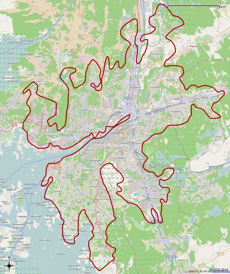
Svenska: Tätorten Göteborgs gränser enligt Atlas över rikets indelningar 1992. |
| Date | |
| Source | OpensStreetmap, Valmyndigheten, Lantmäteriet, SCB |
| Author | Edaen, © OpenStreetMaps bidragsgivare, © Lantmäteriet (ticket:2013101610008901), Valmyndigheten, SCB. |
jpegw EPSG 3857
54.948154432950687 0 0 -54.948154432950687 1309820.1744041499 7931463.0850130711
Licensing
edit
This file is licensed under the Creative Commons Attribution 2.0 Generic license.
- You are free:
- to share – to copy, distribute and transmit the work
- to remix – to adapt the work
- Under the following conditions:
- attribution – You must give appropriate credit, provide a link to the license, and indicate if changes were made. You may do so in any reasonable manner, but not in any way that suggests the licensor endorses you or your use.
File history
Click on a date/time to view the file as it appeared at that time.
| Date/Time | Thumbnail | Dimensions | User | Comment | |
|---|---|---|---|---|---|
| current | 14:47, 9 March 2014 | | 803 × 955 (484 KB) | Edaen (talk | contribs) | black line |
| 18:13, 3 March 2014 |  | 805 × 955 (166 KB) | Edaen (talk | contribs) | User created page with UploadWizard |
You cannot overwrite this file.
File usage on Commons
The following 39 pages use this file:
- Göteborg
- Category:1958 in Göteborg
- Category:1984 in Göteborg
- Category:2007 in Göteborg
- Category:2012 in Göteborg
- Category:2013 in Göteborg
- Category:2015 in Göteborg
- Category:2017 in Göteborg
- Category:Allotments in Göteborg
- Category:Births in Göteborg
- Category:Bridges in Göteborg
- Category:Cemeteries in Göteborg
- Category:Education in Göteborg
- Category:Göteborg
- Category:Göteborg in the 17th century
- Category:Göteborg in the 18th century
- Category:Göteborg in the 1900s
- Category:Göteborg in the 1910s
- Category:Göteborg in the 1920s
- Category:Göteborg in the 1940s
- Category:Göteborg in the 1950s
- Category:Göteborg in the 1960s
- Category:Göteborg in the 1970s
- Category:Göteborg in the 1980s
- Category:Göteborg in the 1990s
- Category:Göteborg in the 19th century
- Category:Göteborg in the 2000s
- Category:Göteborg in the 2010s
- Category:Göteborg in the 2020s
- Category:Göteborg in the 20th century
- Category:Göteborg in the 21st century
- Category:Horse-drawn trams in Göteborg
- Category:Maps of Göteborg
- Category:Music events in Gothenburg
- Category:Musicians from Göteborg
- Category:Sports venues in Göteborg
- Category:Tram transport in Göteborg
- Category:Trams in Göteborg
- Category:Views of Göteborg
File usage on other wikis
The following other wikis use this file:
- Usage on ar.wikipedia.org
- Usage on arz.wikipedia.org
- Usage on ast.wikipedia.org
- Usage on ca.wikipedia.org
- Usage on ceb.wikipedia.org
- Usage on el.wikipedia.org
- Usage on eu.wikipedia.org
- Usage on fi.wikipedia.org
- Usage on ga.wikipedia.org
- Usage on gd.wikipedia.org
- Usage on gl.wikipedia.org
- Usage on hu.wikipedia.org
- Usage on ia.wikipedia.org
- Usage on la.wikipedia.org
- Usage on lld.wikipedia.org
- Usage on ro.wikipedia.org
- Usage on sv.wikipedia.org
- Usage on tt.wikipedia.org
- Usage on vi.wikipedia.org
- Usage on vo.wikipedia.org
- Usage on www.wikidata.org