File:G7211 Nanyou Expressway Guangxi outline.svg

Size of this PNG preview of this SVG file: 697 × 599 pixels. Other resolutions: 279 × 240 pixels | 558 × 480 pixels | 893 × 768 pixels | 1,191 × 1,024 pixels | 2,382 × 2,048 pixels | 834 × 717 pixels.
Original file (SVG file, nominally 834 × 717 pixels, file size: 27 KB)
Captions
Captions
Add a one-line explanation of what this file represents
Summary edit
| Description |
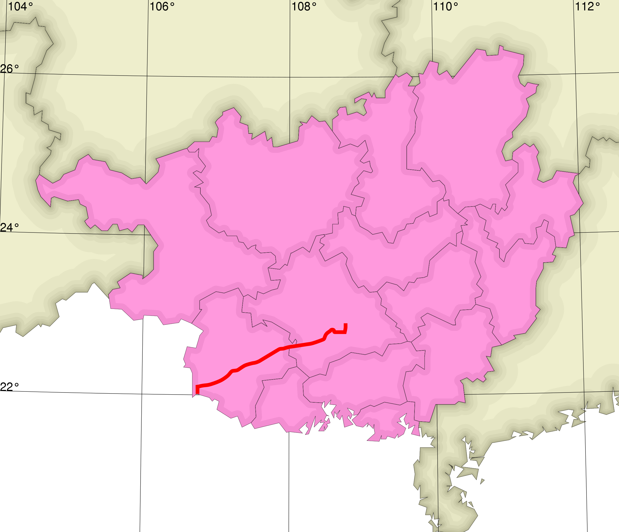
English: Map showing the route of G7211 Nanning–Youyiguan Expressway in Guangxi Zhuang Autonomous Region. 中文:中国G7211南宁–友谊关高速公路在广西壮族自治区的线路 |
| Date | |
| Source | Own work |
| Author |
Modifications by Heights Derivative work by Lincun at the Japanese Wikipedia. |

Based on map by Lincun at ja.wikipedia GFDL (http://www.gnu.org/copyleft/fdl.html) or CC-BY-SA-3.0 (https://creativecommons.org/licenses/by-sa/3.0/), from Wikimedia Commons
Licensing edit
I, the copyright holder of this work, hereby publish it under the following license:
This file is licensed under the Creative Commons Attribution-Share Alike 3.0 Unported license.
- You are free:
- to share – to copy, distribute and transmit the work
- to remix – to adapt the work
- Under the following conditions:
- attribution – You must give appropriate credit, provide a link to the license, and indicate if changes were made. You may do so in any reasonable manner, but not in any way that suggests the licensor endorses you or your use.
- share alike – If you remix, transform, or build upon the material, you must distribute your contributions under the same or compatible license as the original.
File history
Click on a date/time to view the file as it appeared at that time.
| Date/Time | Thumbnail | Dimensions | User | Comment | |
|---|---|---|---|---|---|
| current | 00:58, 24 May 2013 | | 834 × 717 (27 KB) | Heights (talk | contribs) | User created page with UploadWizard |
You cannot overwrite this file.
File usage on Commons
The following page uses this file:
File usage on other wikis
The following other wikis use this file:
- Usage on en.wikipedia.org
- Usage on ja.wikipedia.org
- Usage on vi.wikipedia.org
- Usage on www.wikidata.org
- Usage on zh.wikipedia.org