File:GENERAL VIEW FROM SOUTHWEST, A DUPLICATE OF AN HISTORIC VIEW - Cerealine Manufacturing Company, Mill A, Jackson and Brown Streets, Columbus, Bartholomew County, IN HAER IND,3-COLU,2A-3.tif

Size of this JPG preview of this TIF file: 800 × 574 pixels. Other resolutions: 320 × 230 pixels | 640 × 459 pixels | 1,024 × 734 pixels | 1,280 × 918 pixels | 2,560 × 1,836 pixels | 5,000 × 3,586 pixels.
Original file (5,000 × 3,586 pixels, file size: 17.1 MB, MIME type: image/tiff)
Captions
Captions
Add a one-line explanation of what this file represents
Summary edit
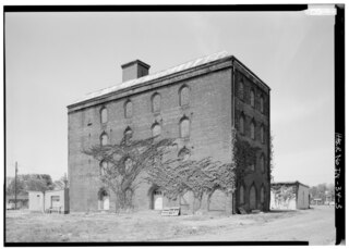
| GENERAL VIEW FROM SOUTHWEST, A DUPLICATE OF AN HISTORIC VIEW - Cerealine Manufacturing Company, Mill A, Jackson and Brown Streets, Columbus, Bartholomew County, IN | ||||
|---|---|---|---|---|
| Title |
GENERAL VIEW FROM SOUTHWEST, A DUPLICATE OF AN HISTORIC VIEW - Cerealine Manufacturing Company, Mill A, Jackson and Brown Streets, Columbus, Bartholomew County, IN |
|||
| Description |
Gaff, Thomas; Gent, Joseph; Vannoy, James; Boucher, Jack E; Rosenberg, Robert; Sackheim, Donald |
|||
| Depicted place | Indiana; Bartholomew County; Columbus | |||
| Date | Documentation compiled after 1968 | |||
| Dimensions | 5 x 7 in. | |||
| Current location |
Library of Congress Prints and Photographs Division Washington, D.C. 20540 USA http://hdl.loc.gov/loc.pnp/pp.print |
|||
| Accession number |
HAER IND,3-COLU,2A-3 |
|||
| Credit line |
|
|||
| Notes |
|
|||
| Source | https://www.loc.gov/pictures/item/in0120.photos.064620p | |||
| Permission (Reusing this file) |
|
|||

| Camera location | | View this and other nearby images on: OpenStreetMap |
|---|
File history
Click on a date/time to view the file as it appeared at that time.
| Date/Time | Thumbnail | Dimensions | User | Comment | |
|---|---|---|---|---|---|
| current | 03:46, 18 July 2014 |  | 5,000 × 3,586 (17.1 MB) | Fæ (talk | contribs) | GWToolset: Creating mediafile for Fæ. HABS 16 July 2014 (1201:1400) |
You cannot overwrite this file.
File usage on Commons
The following page uses this file: