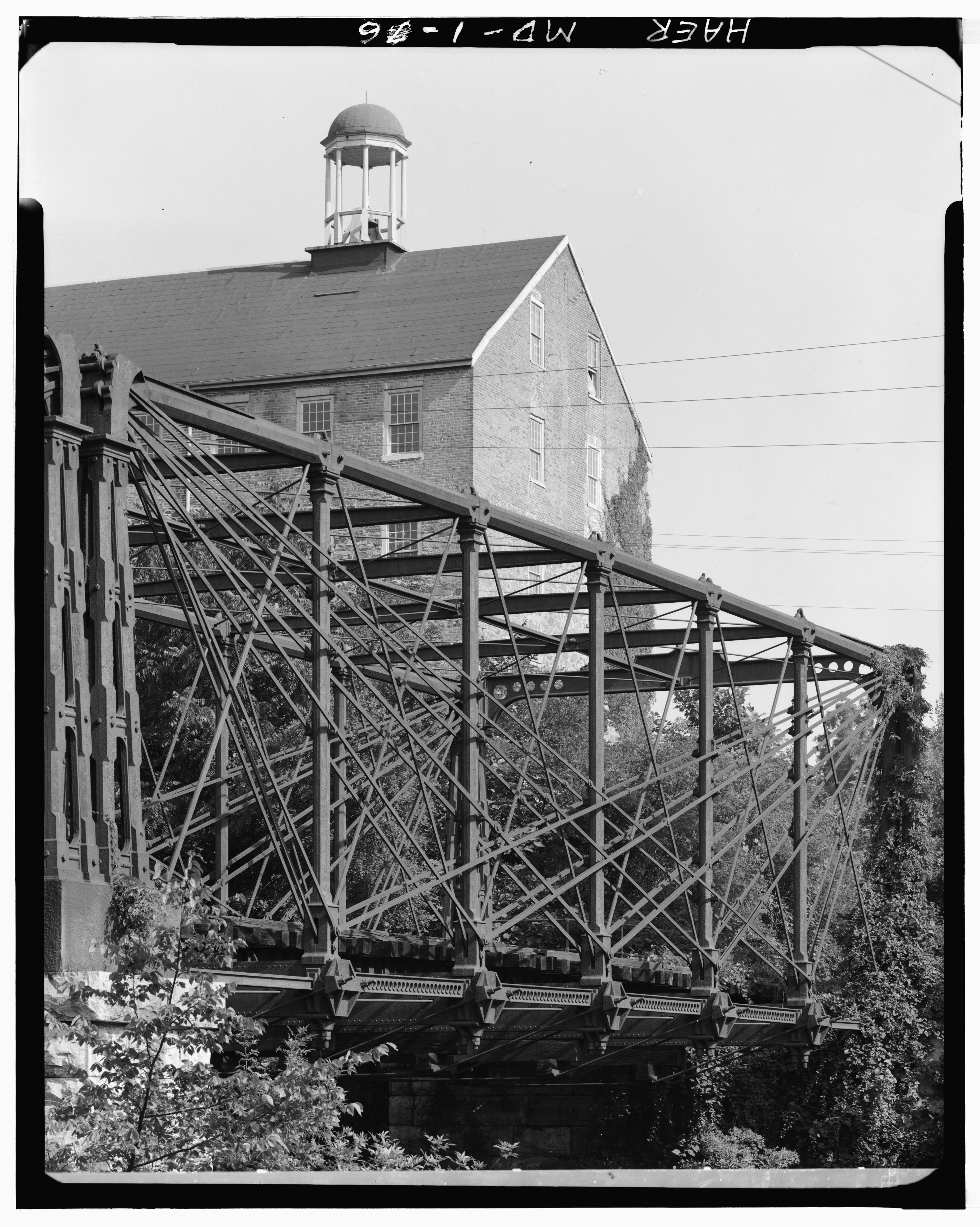
File:GENERAL VIEW OF TRUSS ON EAST SIDE OF BRIDGE, WITH SAVAGE MILL TOWER IN BACKGROUND - Baltimore and Ohio Railroad, Bollman Truss Bridge, Spanning Little Patuxent River, Savage, HAER MD,14-SAV,1-6.tif

Size of this JPG preview of this TIF file: 479 × 599 pixels. Other resolutions: 192 × 240 pixels | 383 × 480 pixels | 614 × 768 pixels | 818 × 1,024 pixels | 1,636 × 2,048 pixels | 3,530 × 4,418 pixels.
Original file (3,530 × 4,418 pixels, file size: 14.88 MB, MIME type: image/tiff)
Captions
Captions
Add a one-line explanation of what this file represents
Summary edit
| GENERAL VIEW OF TRUSS ON EAST SIDE OF BRIDGE, WITH SAVAGE MILL TOWER IN BACKGROUND - Baltimore and Ohio Railroad, Bollman Truss Bridge, Spanning Little Patuxent River, Savage, Howard County, MD | ||||
|---|---|---|---|---|
| Photographer |
Barrett, William E. |
|||
| Title |
GENERAL VIEW OF TRUSS ON EAST SIDE OF BRIDGE, WITH SAVAGE MILL TOWER IN BACKGROUND - Baltimore and Ohio Railroad, Bollman Truss Bridge, Spanning Little Patuxent River, Savage, Howard County, MD |
|||
| Description |
Bollman, Wendel Alan, Designer; Christianson, Justine, transmitter |
|||
| Depicted place | Maryland; Howard County; Savage | |||
| Date | 1970 | |||
| Dimensions | 4 x 5 in. | |||
| Current location |
Library of Congress Prints and Photographs Division Washington, D.C. 20540 USA |
|||
| Accession number |
HAER MD,14-SAV,1-6 |
|||
| Credit line |
|
|||
| Notes |
|
|||
| References |
|
|||
| Source |
|
|||
| Permission (Reusing this file) |
|
|||
| Other versions |
 |
|||


| Object location | | View this and other nearby images on: OpenStreetMap |
|---|
File history
Click on a date/time to view the file as it appeared at that time.
| Date/Time | Thumbnail | Dimensions | User | Comment | |
|---|---|---|---|---|---|
| current | 02:18, 22 July 2014 |  | 3,530 × 4,418 (14.88 MB) | Fæ (talk | contribs) | GWToolset: Creating mediafile for Fæ. HABS 21 July 2014 (1601:1800) |
You cannot overwrite this file.
File usage on Commons
The following 2 pages use this file: