File:GM54RtMap.png
Size of this preview: 800 × 428 pixels. Other resolutions: 320 × 171 pixels | 640 × 343 pixels | 1,024 × 548 pixels | 1,280 × 685 pixels | 2,109 × 1,129 pixels.
Original file (2,109 × 1,129 pixels, file size: 374 KB, MIME type: image/png)
Captions
Captions
Add a one-line explanation of what this file represents
Summary
edit
| Description |
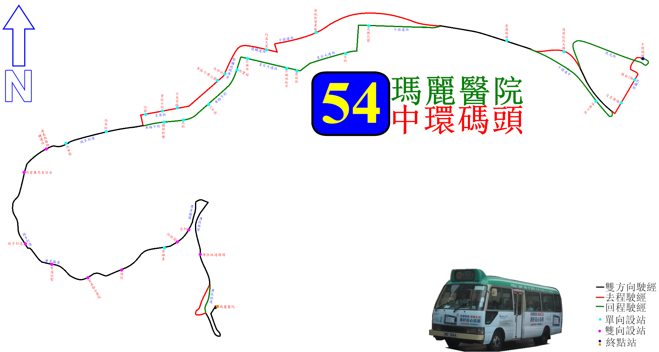
中文(香港):港島專線小巴54線的走線圖 |
| Date | |
| Source | Own work |
| Author | ATR50 |
Licensing
edit
I, the copyright holder of this work, hereby publish it under the following license:
This file is licensed under the Creative Commons Attribution-Share Alike 4.0 International license.
- You are free:
- to share – to copy, distribute and transmit the work
- to remix – to adapt the work
- Under the following conditions:
- attribution – You must give appropriate credit, provide a link to the license, and indicate if changes were made. You may do so in any reasonable manner, but not in any way that suggests the licensor endorses you or your use.
- share alike – If you remix, transform, or build upon the material, you must distribute your contributions under the same or compatible license as the original.
File history
Click on a date/time to view the file as it appeared at that time.
| Date/Time | Thumbnail | Dimensions | User | Comment | |
|---|---|---|---|---|---|
| current | 03:20, 24 March 2017 | | 2,109 × 1,129 (374 KB) | ATR50~commonswiki (talk | contribs) | Reverted to version as of 03:17, 16 August 2014 (UTC) |
| 16:45, 23 June 2015 |  | 2,109 × 1,129 (385 KB) | ATR50~commonswiki (talk | contribs) | 新增54M線走線資訊 | |
| 03:17, 16 August 2014 |  | 2,109 × 1,129 (374 KB) | ATR50~commonswiki (talk | contribs) | 8月中加圖 | |
| 12:12, 23 July 2014 |  | 2,109 × 1,129 (186 KB) | ATR50~commonswiki (talk | contribs) | User created page with UploadWizard |
You cannot overwrite this file.
File usage on Commons
The following 6 pages use this file:
- User:Chumwa/OgreBot/Potential transport maps/2017 March 21-31
- User:Chumwa/OgreBot/Public transport information/2015 June 21-30
- User:Chumwa/OgreBot/Public transport information/2017 March 21-31
- User:Chumwa/OgreBot/Transport Maps/2015 June 21-30
- User:Chumwa/OgreBot/Transport Maps/2017 March 21-31
- User:Chumwa/OgreBot/Travel and communication maps/2017 March 21-31
File usage on other wikis
The following other wikis use this file:
- Usage on zh.wikipedia.org