File:GSD-Sverigekartan (juli 2015).jpg

Size of this preview: 267 × 599 pixels. Other resolutions: 107 × 240 pixels | 214 × 480 pixels | 342 × 768 pixels | 456 × 1,024 pixels | 913 × 2,048 pixels | 7,000 × 15,700 pixels.
Original file (7,000 × 15,700 pixels, file size: 13.18 MB, MIME type: image/jpeg)
Captions
Captions
Add a one-line explanation of what this file represents
Summary
edit.jpg&action=edit§ion=1)
| Warning | The original file is very high-resolution. It might not load properly or could cause your browser to freeze when opened at full size. |
|---|
.jpg&flash=no)
| Description |
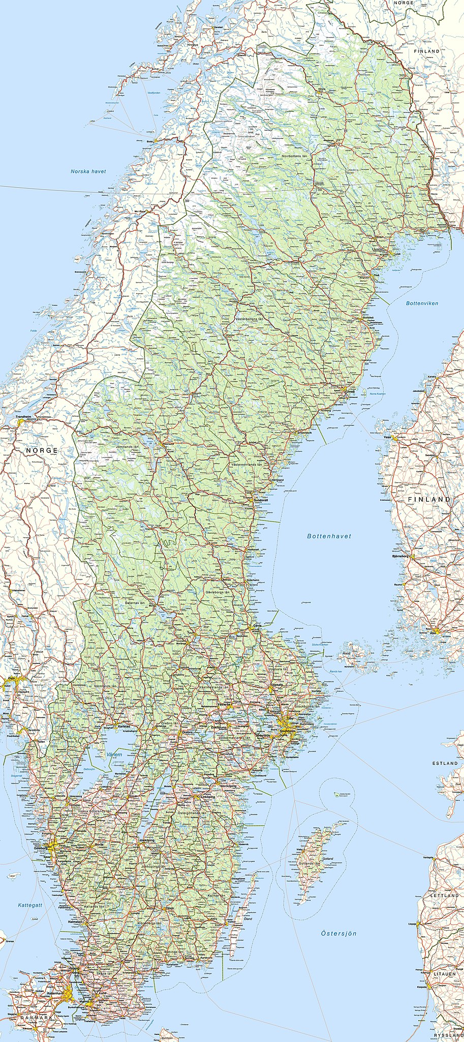
Svenska: Sverigekartan, juli 2015, i skala 1:1 000 000, tillverkad av statliga Lantmäteriet. OBS: Filen är stor, och den lämpar sig bättre som utgångspunkt för separata kartutsnitt över mindre delar av Sverige. English: "Sverigekartan", a map overview of Sweden produced by the national cartography institution Lantmäteriet. NB: Due to the file size, it could be impractical to include on a Wikipedia page, better used in chopped-up portions. |
| Date | |
| Source | http://www.lantmateriet.se/sv/Kartor-och-geografisk-information/Kartor/oppna-data/hamta-oppna-geodata/#faq:sverige-11-miljon-raster |
| Author | Lantmäteriet |
Licensing
edit.jpg&action=edit§ion=2)
This file is licensed under the Creative Commons Attribution 4.0 International license.
- You are free:
- to share – to copy, distribute and transmit the work
- to remix – to adapt the work
- Under the following conditions:
- attribution – You must give appropriate credit, provide a link to the license, and indicate if changes were made. You may do so in any reasonable manner, but not in any way that suggests the licensor endorses you or your use.
File history
Click on a date/time to view the file as it appeared at that time.
| Date/Time | Thumbnail | Dimensions | User | Comment | |
|---|---|---|---|---|---|
| current | 12:11, 18 July 2015 | | 7,000 × 15,700 (13.18 MB) | Paracel63 (talk | contribs) | User created page with UploadWizard |
You cannot overwrite this file.
File usage on Commons
There are no pages that use this file.
.jpg&oldid=664422390)