File:GS Ängelholm.svg

Size of this PNG preview of this SVG file: 791 × 599 pixels. Other resolutions: 317 × 240 pixels | 634 × 480 pixels | 1,014 × 768 pixels | 1,280 × 970 pixels | 2,560 × 1,939 pixels | 6,002 × 4,547 pixels.
Original file (SVG file, nominally 6,002 × 4,547 pixels, file size: 215 KB)
Captions
Captions
Add a one-line explanation of what this file represents
| Description |
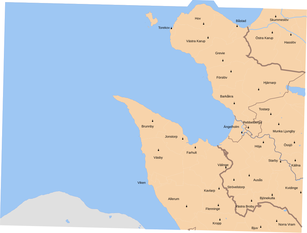
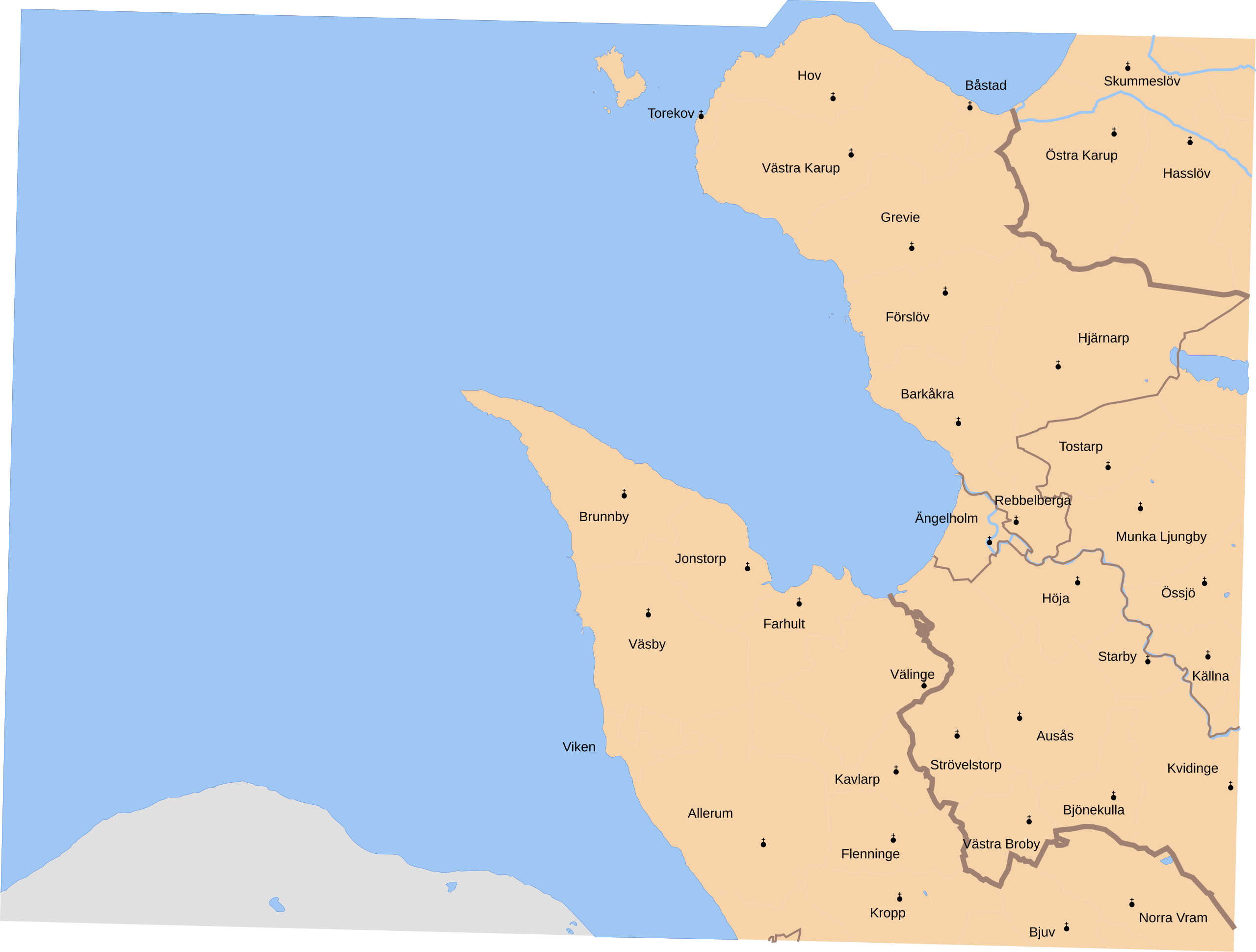
English: Map showing borders of parishes and hundreds in the vicinity of Ängelholm, based on information from map by Topografiska Corpsen.
'3. Ängelholm Grav. af C. Schleich. Topografiska Corpsens karta öfver Sverige 1861. Hallands länsdel öfversedd 1895. |
| Date | (1861/1895) |
| Source | Lantmäteriet |
| Author | Own work, and Topografiska Corpsen |
| Permission (Reusing this file) |
This file is licensed under the Creative Commons Attribution 3.0 Unported license. Attribution: Edaen
|
| Other versions |
Derivative works of this file: |
File history
Click on a date/time to view the file as it appeared at that time.
| Date/Time | Thumbnail | Dimensions | User | Comment | |
|---|---|---|---|---|---|
| current | 08:20, 25 September 2010 | | 6,002 × 4,547 (215 KB) | Edaen (talk | contribs) | "fit page to selection" |
| 08:18, 25 September 2010 |  | 744 × 1,052 (225 KB) | Edaen (talk | contribs) | {{Information |Description={{en|1=Map showing borders of parishes and hundreds in the vicinity of Ängelholm, based on information from map by Topografiska Corpsen. <small>''''''3. Ängelholm''' Grav. af C. Schleich. Topografiska Corpsens karta öfver S |
You cannot overwrite this file.
File usage on Commons
The following 11 pages use this file: