File:GS Uddevalla.svg

Size of this PNG preview of this SVG file: 788 × 599 pixels. Other resolutions: 316 × 240 pixels | 631 × 480 pixels | 1,010 × 768 pixels | 1,280 × 974 pixels | 2,560 × 1,947 pixels | 5,922 × 4,505 pixels.
Original file (SVG file, nominally 5,922 × 4,505 pixels, file size: 680 KB)
Captions
Captions
Add a one-line explanation of what this file represents
| Description |
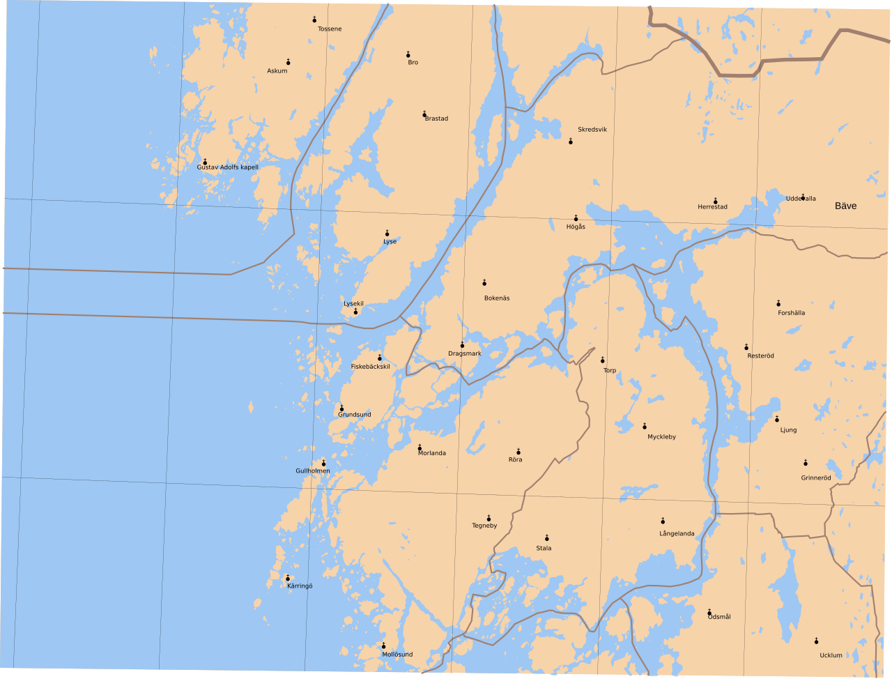
English: Map showing borders of parishes and hundreds in the vicinity of Uddevalla, based on information from map by Topografiska Corpsen.
Uddevalla
|
| Date | (1858) |
| Source | Lantmäteriet |
| Author | Own work, and Topografiska Corpsen |
| Permission (Reusing this file) |
This file is licensed under the Creative Commons Attribution 3.0 Unported license. Attribution: Edaen
|
| Other versions |
Derivative works of this file: |
File history
Click on a date/time to view the file as it appeared at that time.
| Date/Time | Thumbnail | Dimensions | User | Comment | |
|---|---|---|---|---|---|
| current | 08:56, 14 September 2010 | | 5,922 × 4,505 (680 KB) | Edaen (talk | contribs) | {{Information |Description={{en|1=Map showing borders of parishes and hundreds in the vicinity of Uddevalla, based on information from map by Topografiska Corpsen. <small>'''Uddevalla''' Topografiska Corpsens Karta öfver Sverige 1844. Öfversedd 1858. |
You cannot overwrite this file.
File usage on Commons
There are no pages that use this file.