File:Gaiberg2017-06-03-11-11-58.jpg

Size of this preview: 800 × 533 pixels. Other resolutions: 320 × 213 pixels | 640 × 427 pixels | 1,024 × 683 pixels | 1,280 × 853 pixels | 2,560 × 1,707 pixels | 6,000 × 4,000 pixels.
Original file (6,000 × 4,000 pixels, file size: 10.75 MB, MIME type: image/jpeg)
Captions
Captions
Add a one-line explanation of what this file represents
Summary
edit
| Description |
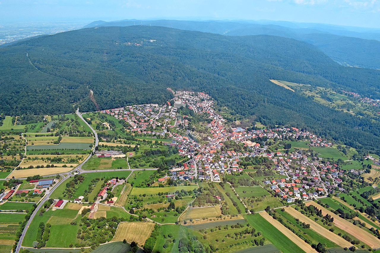
Deutsch: Luftaufnahme von Gaiberg aus einem Tragschrauber heraus, Blickrichtung Süd-Nord Richtung Heidelberg-Königstuhl. Links oben in der Ebene ist Heidelberg, rechts oben ist ein Stück vom Neckar kurz vor Neckargemünd zu erkennen. English: Aerial view of Gaiberg from a gyrocopter, south-north direction towards Heidelberg-Königstuhl. On the top left in the plain is Heidelberg, on the top right is a part of the Neckar just before Neckargemünd. |
| Date | |
| Source |
Own work Original text: selbst fotografiert |
| Author | Rolf Kickuth |
Licensing
edit
This file is licensed under the Creative Commons Attribution-Share Alike 3.0 Germany license.
- You are free:
- to share – to copy, distribute and transmit the work
- to remix – to adapt the work
- Under the following conditions:
- attribution – You must give appropriate credit, provide a link to the license, and indicate if changes were made. You may do so in any reasonable manner, but not in any way that suggests the licensor endorses you or your use.
- share alike – If you remix, transform, or build upon the material, you must distribute your contributions under the same or compatible license as the original.

This file is licensed under the Creative Commons Attribution-Share Alike 3.0 Unported license.
- You are free:
- to share – to copy, distribute and transmit the work
- to remix – to adapt the work
- Under the following conditions:
- attribution – You must give appropriate credit, provide a link to the license, and indicate if changes were made. You may do so in any reasonable manner, but not in any way that suggests the licensor endorses you or your use.
- share alike – If you remix, transform, or build upon the material, you must distribute your contributions under the same or compatible license as the original.

|
Permission is granted to copy, distribute and/or modify this document under the terms of the GNU Free Documentation License, Version 1.2 or any later version published by the Free Software Foundation; with no Invariant Sections, no Front-Cover Texts, and no Back-Cover Texts. A copy of the license is included in the section entitled GNU Free Documentation License. |
Original upload log
edit
Transferred from de.wikipedia to Commons by Wdwdbot using script bot_filetrans.pl (r110M).
The original description page was here. All following user names refer to de.wikipedia.
- 2019-01-12 19:01:02 Laniakea-rubikon (11271920 Bytes) {{Information |Beschreibung = Luftaufnahme von Gaiberg aus einem Tragschrauber heraus, Blickrichtung Süd-Nord Richtung Heidelberg-Königstuhl |Quelle = selbst fotografiert |Urheber = Rolf Kickuth |Datum = 3.6.2017 |Genehmigung = |Andere Versionen = |Anmerkungen = }}Luftaufnahme von Gaiberg aus einem Tragschrauber heraus, Blickrichtung Süd-Nord Richtung Heidelberg-Königstuhl English: Aerial view of Gaiberg from a gyrocopter, south-north direction tow…
| Annotations | This image is annotated: View the annotations at Commons |
File history
Click on a date/time to view the file as it appeared at that time.
| Date/Time | Thumbnail | Dimensions | User | Comment | |
|---|---|---|---|---|---|
| current | 11:27, 14 January 2019 | | 6,000 × 4,000 (10.75 MB) | Wdwdbot (talk | contribs) | Bot Move: Original uploader of this revision (#1) was Laniakea-rubikon at de.wikipedia |
You cannot overwrite this file.
File usage on Commons
The following 3 pages use this file:
File usage on other wikis
The following other wikis use this file:
- Usage on de.wikipedia.org
- Usage on pfl.wikipedia.org