File:Gamboa panorama from Plateau on Praia, Cape Verde.jpg
Size of this preview: 799 × 214 pixels. Other resolutions: 320 × 86 pixels | 640 × 172 pixels | 1,024 × 275 pixels | 1,280 × 343 pixels | 2,560 × 686 pixels | 14,277 × 3,828 pixels.
Original file (14,277 × 3,828 pixels, file size: 43.71 MB, MIME type: image/jpeg)
File information
Structured data
Captions
Summary
editDescriptionGamboa panorama from Plateau on Praia, Cape Verde.jpg |
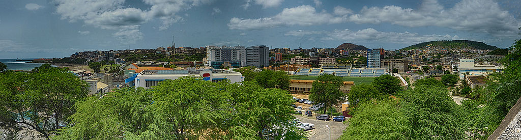
English: Gamboa panorama from Plateau on Praia, Cape Verde |
||
Date | |||
Source | Own work | ||
Author | Reino Baptista | ||
Other versions |
|
Camera location | 14° 54′ 58.95″ N, 23° 30′ 37.36″ W | View this and other nearby images on: OpenStreetMap | 14.916375; -23.510378 |
---|
Licensing
editI, the copyright holder of this work, hereby publish it under the following license:
This file is licensed under the Creative Commons Attribution-Share Alike 4.0 International license.
- You are free:
- to share – to copy, distribute and transmit the work
- to remix – to adapt the work
- Under the following conditions:
- attribution – You must give appropriate credit, provide a link to the license, and indicate if changes were made. You may do so in any reasonable manner, but not in any way that suggests the licensor endorses you or your use.
- share alike – If you remix, transform, or build upon the material, you must distribute your contributions under the same or compatible license as the original.
File history
Click on a date/time to view the file as it appeared at that time.
Date/Time | Thumbnail | Dimensions | User | Comment | |
---|---|---|---|---|---|
current | 17:42, 29 November 2014 | 14,277 × 3,828 (43.71 MB) | Reino Baptista (talk | contribs) | User created page with UploadWizard |
You cannot overwrite this file.
File usage on Commons
The following page uses this file:
File usage on other wikis
The following other wikis use this file:
- Usage on fr.wikipedia.org
- Usage on ga.wikipedia.org
- Usage on hi.wikipedia.org
- Usage on mdf.wikipedia.org
- Usage on ro.wikipedia.org
- Usage on uk.wikipedia.org
Metadata
This file contains additional information such as Exif metadata which may have been added by the digital camera, scanner, or software program used to create or digitize it. If the file has been modified from its original state, some details such as the timestamp may not fully reflect those of the original file. The timestamp is only as accurate as the clock in the camera, and it may be completely wrong.
Camera manufacturer | Panasonic |
---|---|
Camera model | DMC-TZ40 |
Author | Reino Baptista |
Exposure time | 1/1,600 sec (0.000625) |
F-number | f/3.9 |
ISO speed rating | 200 |
Date and time of data generation | 11:43, 3 October 2014 |
Lens focal length | 6.9 mm |
Latitude | 14° 54′ 58.95″ N |
Longitude | 23° 30′ 37.36″ W |
Altitude | 26 meters above sea level |
Width | 4,896 px |
Height | 3,672 px |
Bits per component |
|
Pixel composition | RGB |
Orientation | Normal |
Number of components | 3 |
Horizontal resolution | 180 dpi |
Vertical resolution | 180 dpi |
Software used | Adobe Photoshop CC (Windows) |
File change date and time | 17:18, 29 November 2014 |
Y and C positioning | Co-sited |
Exposure Program | Landscape mode (for landscape photos with the background in focus) |
Exif version | 2.3 |
Date and time of digitizing | 11:43, 3 October 2014 |
Meaning of each component |
|
Image compression mode | 4 |
APEX shutter speed | 10.643856 |
APEX aperture | 3.926948 |
APEX exposure bias | 0 |
Maximum land aperture | 3.890625 APEX (f/3.85) |
Metering mode | Pattern |
Light source | Unknown |
Flash | Flash did not fire, compulsory flash suppression |
Supported Flashpix version | 1 |
Color space | sRGB |
Sensing method | One-chip color area sensor |
File source | Digital still camera |
Scene type | A directly photographed image |
Custom image processing | Normal process |
Exposure mode | Auto bracket |
White balance | Auto white balance |
Digital zoom ratio | 0 |
Focal length in 35 mm film | 40 mm |
Scene capture type | Standard |
Scene control | Low gain up |
Contrast | Normal |
Saturation | Normal |
Sharpness | Normal |
GPS time (atomic clock) | 12:43 |
Receiver status | Measurement in progress |
Measurement mode | 2-dimensional measurement |
Measurement precision | Moderate (0.8) |
Reference for direction of image | True direction |
Direction of image | 180 |
Geodetic survey data used | WGS-84 |
Name of GPS area | Praia |
GPS date | 3 October 2014 |
GPS tag version | 0.0.3.2 |
Date metadata was last modified | 17:18, 29 November 2014 |
Unique ID of original document | 5C181A405F310489514E086B07B3DF9F |
Keywords |
|
Province or state shown | Praia |
Country shown | Cape Verde |
Code for country shown | CPV |
Sublocation of city shown | Praia |