File:Ganrneddwen Halt railway station (site), Gwynedd (geograph 4667811).jpg
Size of this preview: 800 × 600 pixels. Other resolutions: 320 × 240 pixels | 640 × 480 pixels | 1,024 × 768 pixels | 1,280 × 960 pixels | 1,600 × 1,200 pixels.
Original file (1,600 × 1,200 pixels, file size: 473 KB, MIME type: image/jpeg)
Captions
Captions
Add a one-line explanation of what this file represents
Summary
edit,_Gwynedd_(geograph_4667811).jpg&action=edit§ion=1)
| Description |
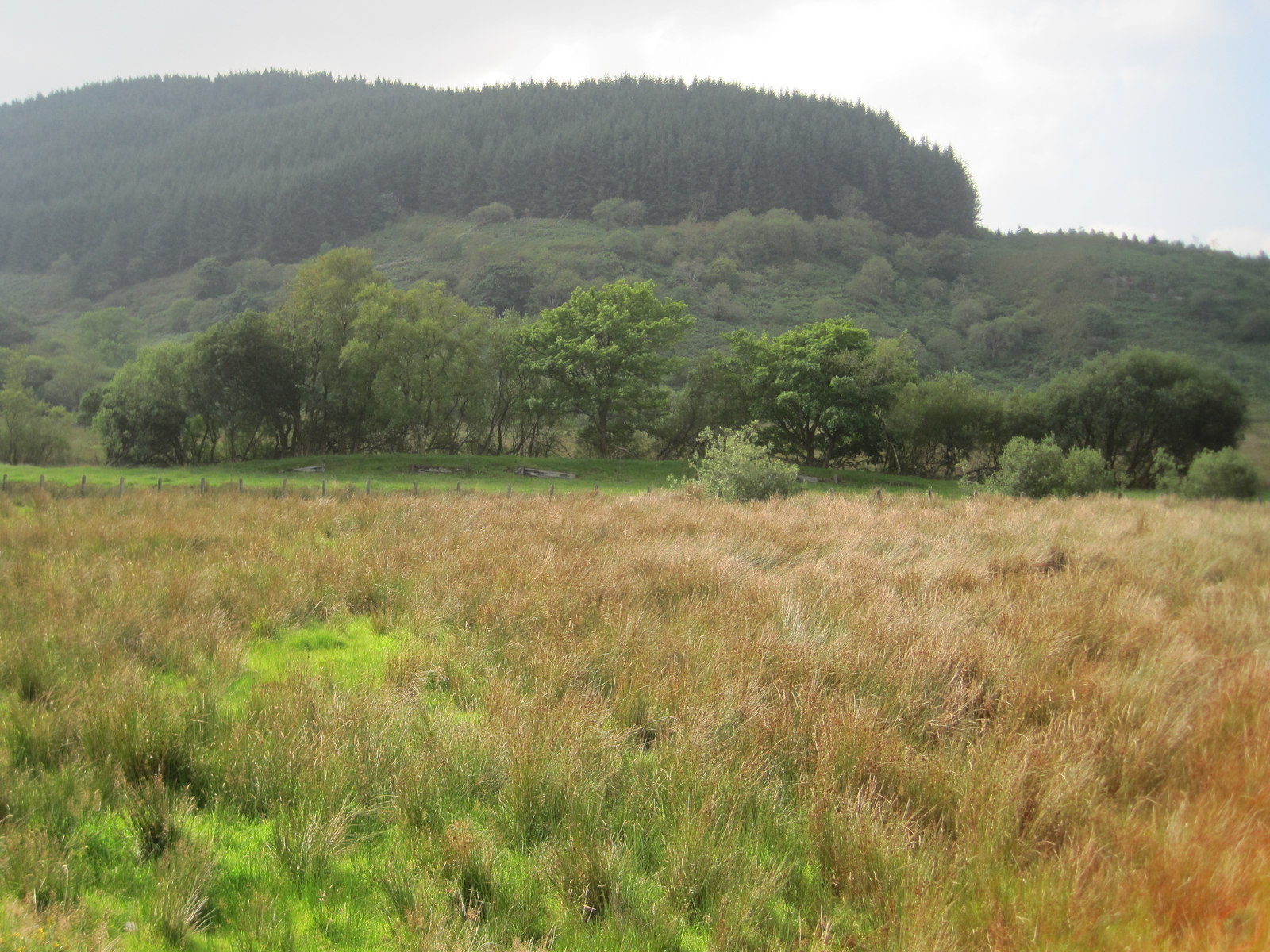
English: Ganrneddwen Halt railway station (site), Gwynedd Opened in 1928 by the Great Western Railway on the line from Ruabon and Bala to Dolgellau, this station closed in 1965 and the track was lifted. View west from the A494. The line ran left to right in front of the trees, in front of which are the remains of the wooden-sided platform. |
| Date | |
| Source | From geograph.org.uk |
| Author | Nigel Thompson |
| Permission (Reusing this file) |
Creative Commons Attribution Share-alike license 2.0 |
| Attribution (required by the license) | Nigel Thompson / Ganrneddwen Halt railway station (site), Gwynedd / |
| Camera location | | View this and other nearby images on: OpenStreetMap |
|---|
,_Gwynedd_(geograph_4667811).jpg¶ms=052.828419_N_-003.706663_E_globe:Earth_type:camera_source:geograph-osgb36(SH85112702)_heading:270.00&language=en)
| Object location | | View this and other nearby images on: OpenStreetMap |
|---|
,_Gwynedd_(geograph_4667811).jpg¶ms=052.828400_N_-003.707700_E_globe:Earth_class:object_type:object_source:geograph-osgb36(SH85042702)_heading:270.00&language=en)
Licensing
edit,_Gwynedd_(geograph_4667811).jpg&action=edit§ion=2)

|
This image was taken from the Geograph project collection. See this photograph's page on the Geograph website for the photographer's contact details. The copyright on this image is owned by Nigel Thompson and is licensed for reuse under the Creative Commons Attribution-ShareAlike 2.0 license.
|
This file is licensed under the Creative Commons Attribution-Share Alike 2.0 Generic license.
Attribution: Nigel Thompson
- You are free:
- to share – to copy, distribute and transmit the work
- to remix – to adapt the work
- Under the following conditions:
- attribution – You must give appropriate credit, provide a link to the license, and indicate if changes were made. You may do so in any reasonable manner, but not in any way that suggests the licensor endorses you or your use.
- share alike – If you remix, transform, or build upon the material, you must distribute your contributions under the same or compatible license as the original.
File history
Click on a date/time to view the file as it appeared at that time.
| Date/Time | Thumbnail | Dimensions | User | Comment | |
|---|---|---|---|---|---|
| current | 19:36, 2 January 2020 | | 1,600 × 1,200 (473 KB) | Lamberhurst (talk | contribs) | Transferred from geograph.co.uk using [https://tools.wmflabs.org/geograph2commons/ geograph2commons] |
You cannot overwrite this file.
File usage on Commons
The following 4 pages use this file:
,_Gwynedd_(geograph_4667811).jpg&oldid=547151645)