File:Gare de Cusset en construction.jpg
![File:Gare de Cusset en construction.jpg](https://upload.wikimedia.org/wikipedia/commons/thumb/a/a4/Gare_de_Cusset_en_construction.jpg/800px-Gare_de_Cusset_en_construction.jpg?20210604112604)
Original file (2,669 × 1,335 pixels, file size: 983 KB, MIME type: image/jpeg)
Captions
Captions
Summary
editDescriptionGare de Cusset en construction.jpg |
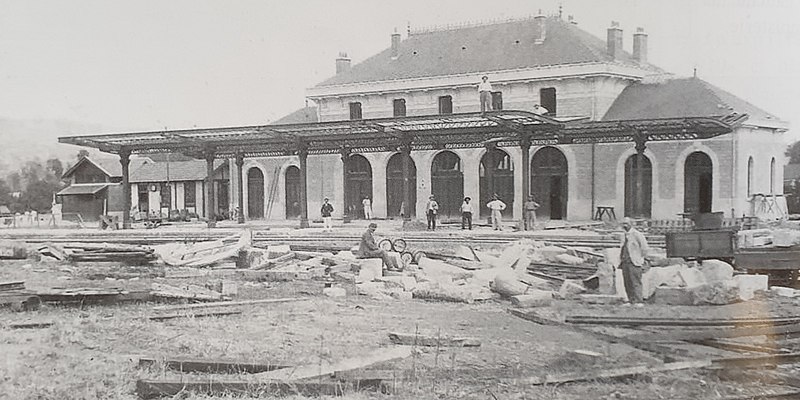
Français : Gare de Cusset en construction |
Date | |
Source | Gares et trains, Mémoires d'Allier de Patrick Kessler et Thierry Wirth |
Author | Unknown authorUnknown author |
Camera location | 46° 08′ 20″ N, 3° 27′ 28.15″ E ![]() | View this and other nearby images on: OpenStreetMap | ![]() |
---|
Licensing
editPublic domainPublic domainfalsefalse |
![]() |
This work is in the public domain in its country of origin and other countries and areas where the copyright term is the author's life plus 70 years or fewer. This work is in the public domain in the United States because it was published (or registered with the U.S. Copyright Office) before January 1, 1929. |
This file has been identified as being free of known restrictions under copyright law, including all related and neighboring rights. |
https://creativecommons.org/publicdomain/mark/1.0/PDMCreative Commons Public Domain Mark 1.0falsefalse
![]() |
This file was uploaded via Mobile Android App (Commons mobile app) 2.13.2~757c7b008. |
File history
Click on a date/time to view the file as it appeared at that time.
Date/Time | Thumbnail | Dimensions | User | Comment | |
---|---|---|---|---|---|
current | 11:26, 4 June 2021 | ![]() | 2,669 × 1,335 (983 KB) | TCY (talk | contribs) | Uploaded using Commons Mobile App |
You cannot overwrite this file.
File usage on Commons
The following 2 pages use this file:
File usage on other wikis
The following other wikis use this file:
- Usage on fr.wikipedia.org
Metadata
This file contains additional information such as Exif metadata which may have been added by the digital camera, scanner, or software program used to create or digitize it. If the file has been modified from its original state, some details such as the timestamp may not fully reflect those of the original file. The timestamp is only as accurate as the clock in the camera, and it may be completely wrong.
Date and time of data generation | 15:04, 19 May 2021 |
---|---|
Exposure time | 1/50 sec (0.02) |
F-number | f/2.4 |
ISO speed rating | 80 |
Lens focal length | 4.3 mm |
Latitude | 46° 7′ 16.64″ N |
Altitude | 313 meters above sea level |
Longitude | 3° 25′ 28.78″ E |
Vertical resolution | 72 dpi |
Horizontal resolution | 72 dpi |
Width | 2,669 px |
Height | 1,335 px |
Y and C positioning | Centered |
Orientation | 0 |
File change date and time | 13:25, 4 June 2021 |
APEX aperture | 2.52 |
Scene type | A directly photographed image |
Exif version | 2.2 |
APEX exposure bias | 0 |
Exposure Program | Normal program |
Unique image ID | J12LLKL00SM |
Color space | sRGB |
Maximum land aperture | 1.16 APEX (f/1.49) |
APEX brightness | 3.3 |
Supported Flashpix version | 1 |
DateTimeOriginal subseconds | 0489 |
White balance | Auto white balance |
Custom image processing | Normal process |
Exposure mode | Auto exposure |
Flash | Flash did not fire |
DateTime subseconds | 0489 |
Saturation | Normal |
Meaning of each component |
|
Focal length in 35 mm film | 26 mm |
DateTimeDigitized subseconds | 0489 |
Sharpness | Normal |
Contrast | Normal |
Date and time of digitizing | 15:04, 19 May 2021 |
APEX shutter speed | 5.64 |
Metering mode | Center weighted average |
Scene capture type | Standard |
Light source | Unknown |
GPS time (atomic clock) | 13:04 |
GPS date | 19 May 2021 |
GPS tag version | 2.2.0.0 |