File:Gbg1719-2.jpg

Size of this preview: 800 × 497 pixels. Other resolutions: 320 × 199 pixels | 640 × 398 pixels | 1,024 × 637 pixels | 1,280 × 796 pixels | 2,560 × 1,592 pixels | 3,508 × 2,181 pixels.
Original file (3,508 × 2,181 pixels, file size: 572 KB, MIME type: image/jpeg)
Captions
Captions
Add a one-line explanation of what this file represents
Summary
edit
| Description |
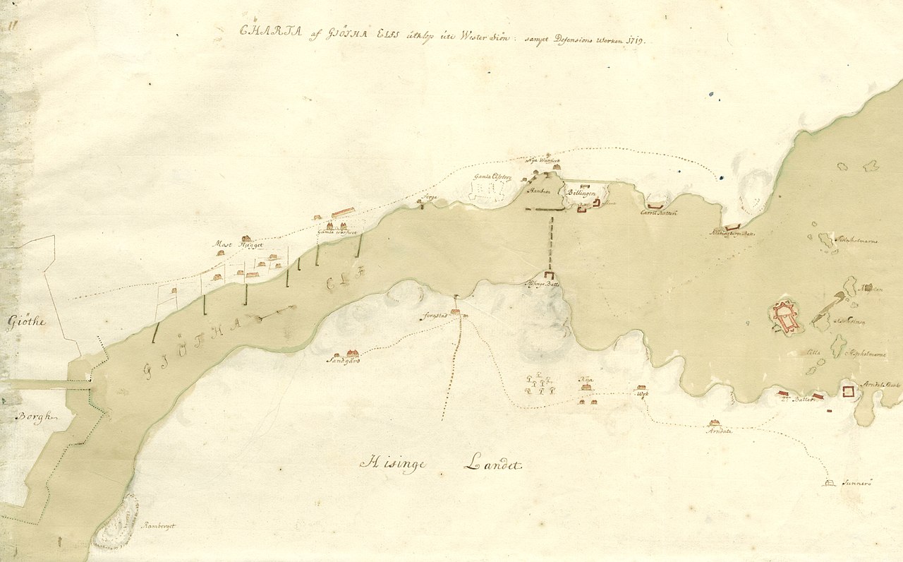
English: Map of the Göteborg harbour entrance, and surrounding defence positions, at he time of the admiral Tordenskjold attack, autumn 1719.
Svenska: "Charta af Giötha uthlop uti Wester Siön samt Defensions Werken 1719". Göteborgs hamninlopp sett från norr (Hisingen) i samband med amiral Tordenskjolds attack hösten 1719. |
| Date | |
| Source |
Krigsarkivet: Sveriges Krig, Stora Nordiska Kriget 0425:14:099 1719 https://sok.riksarkivet.se/arkiv/msL8Fy8Kzr5gnzKT8BP5hN |
| Author | Unknown author |
Licensing
edit
|
This work is in the public domain in its country of origin and other countries and areas where the copyright term is the author's life plus 100 years or fewer. | |
| This file has been identified as being free of known restrictions under copyright law, including all related and neighboring rights. | |
File history
Click on a date/time to view the file as it appeared at that time.
| Date/Time | Thumbnail | Dimensions | User | Comment | |
|---|---|---|---|---|---|
| current | 19:22, 30 May 2013 | | 3,508 × 2,181 (572 KB) | Dagjoh (talk | contribs) | {{Information |Description ={{en|1=Map of the Göteborg harbour entrance, and surrounding defence positions, at he time of the admiral Tordenskjold attack, autumn 1719.}} {{sv|1="Charta af Giötha uthlop uti Wester Siön samt Defensions Werken 1719"... |
You cannot overwrite this file.
File usage on Commons
There are no pages that use this file.
File usage on other wikis
The following other wikis use this file:
- Usage on sv.wikipedia.org