File:Gebietskarte BOS Leitstellen Deutschland.svg

Size of this PNG preview of this SVG file: 443 × 600 pixels. Other resolutions: 177 × 240 pixels | 354 × 480 pixels | 567 × 768 pixels | 756 × 1,024 pixels | 1,513 × 2,048 pixels.
Original file (SVG file, nominally 800 × 1,083 pixels, file size: 1.39 MB)
Captions
Captions
Add a one-line explanation of what this file represents
Summary
edit
| Description |
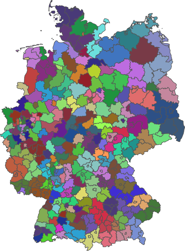
Deutsch: Die Karte zeigt die Einzugsgebiete der BOS Leitstellen in Deutschland auf Landkreisebene. Die Karte wurde aus den Tabellendaten der Liste der BOS-Leitstellen erstellt. |
| Date | |
| Source | https://gdz.bkg.bund.de/index.php/default/open-data/verwaltungsgebiete-1-250-000-ebenen-stand-31-12-vg250-ebenen-31-12.html |
| Author | © GeoBasis-DE / BKG 2019, Bearbeitung von Maustadt |
Licensing
edit

|
This file is licensed under the terms of the Data licence Germany – attribution – version 2.0 |
|
You are free:
Under the following conditions:
|
File history
Click on a date/time to view the file as it appeared at that time.
| Date/Time | Thumbnail | Dimensions | User | Comment | |
|---|---|---|---|---|---|
| current | 18:27, 26 January 2021 | | 800 × 1,083 (1.39 MB) | Südthüringer (talk | contribs) | Veränderungen in Thüringen Leitstellenlandschaft zum Stichtag 01.01.2021 vorgenommen. |
| 20:54, 23 April 2020 |  | 800 × 1,083 (1.38 MB) | Maustadt (talk | contribs) | Uploaded a work by © GeoBasis-DE / BKG 2019, Bearbeitung von Maustadt from https://gdz.bkg.bund.de/index.php/default/open-data/verwaltungsgebiete-1-250-000-ebenen-stand-31-12-vg250-ebenen-31-12.html with UploadWizard |
You cannot overwrite this file.
File usage on Commons
There are no pages that use this file.
File usage on other wikis
The following other wikis use this file:
- Usage on de.wikipedia.org