File:Geisslochviadukt Dezember 2023 04.jpg

Size of this preview: 800 × 450 pixels. Other resolutions: 320 × 180 pixels | 640 × 360 pixels | 1,024 × 576 pixels | 1,280 × 720 pixels | 2,560 × 1,440 pixels | 4,032 × 2,268 pixels.
Original file (4,032 × 2,268 pixels, file size: 4.3 MB, MIME type: image/jpeg)
Captions
Captions
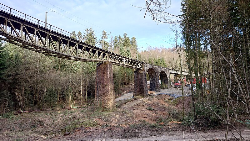
Geissloch viaduct near Bellach, Switzerland
Summary
edit
| Description |
English: Geissloch viaduct in December 2023. Much of the surrounding forest was cleared to make room for upcoming renovation work in 2024, creating a possibility to more easily photograph the old viaduct than it was possible in the last decades. The viaduct will change its appearance as parts of the construction will be replaced.
Deutsch: Geisslochviadukt im Dezember 2023. Da zur Vorbereitung von Erneuerungsarbeiten 2024 umfangreiche Rodungen vorgenommen wurden, ergab sich eine bessere Möglichkeit, den Viadukt zu fotografieren als in den letzten Jahrzehnten. Der Viadukt wird sein Erscheinungsbild ändern, da ein Teil der Konstruktion ersetzt wird. |
| Date | |
| Source | Own work |
| Author | Gestumblindi |
| Camera location | | View this and other nearby images on: OpenStreetMap |
|---|
Licensing
edit
I, the copyright holder of this work, hereby publish it under the following license:
This file is licensed under the Creative Commons Attribution-Share Alike 4.0 International license.
- You are free:
- to share – to copy, distribute and transmit the work
- to remix – to adapt the work
- Under the following conditions:
- attribution – You must give appropriate credit, provide a link to the license, and indicate if changes were made. You may do so in any reasonable manner, but not in any way that suggests the licensor endorses you or your use.
- share alike – If you remix, transform, or build upon the material, you must distribute your contributions under the same or compatible license as the original.
File history
Click on a date/time to view the file as it appeared at that time.
| Date/Time | Thumbnail | Dimensions | User | Comment | |
|---|---|---|---|---|---|
| current | 20:44, 8 January 2024 | | 4,032 × 2,268 (4.3 MB) | Gestumblindi (talk | contribs) | Uploaded own work with UploadWizard |
You cannot overwrite this file.
File usage on Commons
There are no pages that use this file.
File usage on other wikis
The following other wikis use this file:
- Usage on de.wikipedia.org
- Usage on en.wikipedia.org
- Usage on fr.wikipedia.org