File:Gemarkung Hauingen.jpg

Size of this preview: 800 × 572 pixels. Other resolutions: 320 × 229 pixels | 640 × 458 pixels | 1,024 × 732 pixels | 1,280 × 916 pixels | 2,560 × 1,831 pixels | 5,279 × 3,776 pixels.
Original file (5,279 × 3,776 pixels, file size: 5.32 MB, MIME type: image/jpeg)
Captions
Captions
Add a one-line explanation of what this file represents
Summary
edit
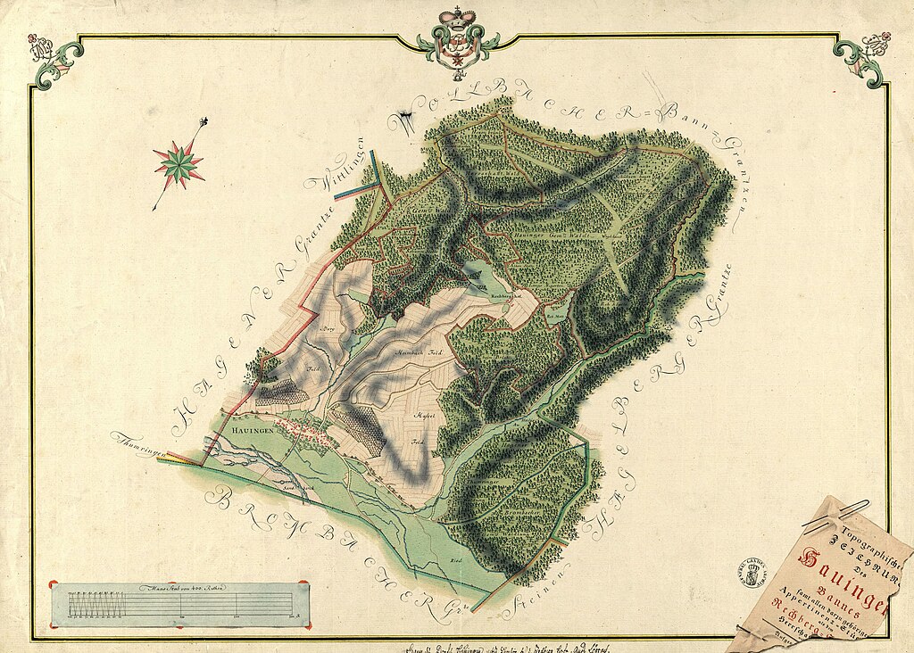
| Description | Gemarkungspläne. Erste badische Landesaufnahme. Topographische Zeichnung Des Hauinger Bannes samt allen darzu gehörigen Appertinenz = Stüc ... als dem Rechberg |
| Date | |
| Source | Landesarchiv Baden-Württemberg, Generallandesarchiv Karlsruhe, H Hauingen 1 [1] |
| Author | Schmauß |
Licensing
edit
|
This work is in the public domain in its country of origin and other countries and areas where the copyright term is the author's life plus 70 years or fewer. This work is in the public domain in the United States because it was published (or registered with the U.S. Copyright Office) before January 1, 1929. | |
| This file has been identified as being free of known restrictions under copyright law, including all related and neighboring rights. | |
File history
Click on a date/time to view the file as it appeared at that time.
| Date/Time | Thumbnail | Dimensions | User | Comment | |
|---|---|---|---|---|---|
| current | 15:59, 5 November 2022 | | 5,279 × 3,776 (5.32 MB) | Zieglhar (talk | contribs) | extract |
| 15:57, 5 November 2022 |  | 5,296 × 4,205 (2.95 MB) | Zieglhar (talk | contribs) | {{Information |Description=Gemarkungspläne. Erste badische Landesaufnahme. Topographische Zeichnung Des Hauinger Bannes samt allen darzu gehörigen Appertinenz = Stüc ... als dem Rechberg |Source=Landesarchiv Baden-Württemberg, Generallandesarchiv Karlsruhe, H Hauingen 1 [http://www.landesarchiv-bw.de/plink/?f=4-1711118] |Date=1776 |Author=Schmauß |Permission= |other_versions= }} Loerrach-Hauingen |
You cannot overwrite this file.
File usage on Commons
The following page uses this file: