File:Gemarkung Oberhau Oberhauer Kirchweg Informationstafel Förderband Hühnerberg.jpg

Size of this preview: 759 × 600 pixels. Other resolutions: 304 × 240 pixels | 607 × 480 pixels | 972 × 768 pixels | 1,280 × 1,012 pixels | 2,560 × 2,023 pixels | 3,887 × 3,072 pixels.
Original file (3,887 × 3,072 pixels, file size: 2.49 MB, MIME type: image/jpeg)
Captions
Captions
Add a one-line explanation of what this file represents
Summary
edit
| Description |
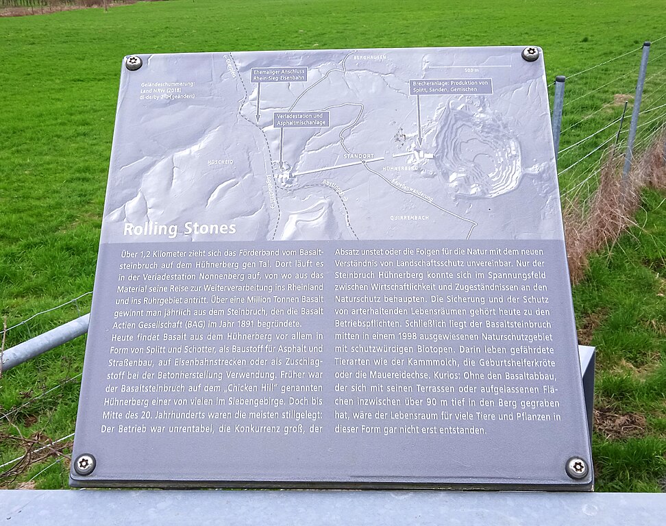
Deutsch: Informationstafel zum Förderband des Basaltsteinbruchs Hühnerberg, Oberhauer Kirchweg (bei Hühnerberg), Gemarkung Oberhau, Stadt Königswinter |
| Date | |
| Source | Self-photographed |
| Author | Image-Improver Bonn |
| Permission (Reusing this file) |
This file is licensed under the Creative Commons Attribution-Share Alike 4.0 International license.
|
| Camera location | | View this and other nearby images on: OpenStreetMap |
|---|
|
The photographical reproduction of this work is covered under the article § 59 of the German copyright law, which states that "It shall be permissible to reproduce, by painting, drawing, photography or cinematography, works which are permanently located on public ways, streets or places and to distribute and publicly communicate such copies. For works of architecture, this provision shall be applicable only to the external appearance."
As with all other “limits of copyright by legally permitted uses”, no changes to the actual work are permitted under § 62 of the German copyright law (UrhG). See Commons:Copyright rules by territory/Germany#Freedom of panorama for more information.
|
File history
Click on a date/time to view the file as it appeared at that time.
| Date/Time | Thumbnail | Dimensions | User | Comment | |
|---|---|---|---|---|---|
| current | 12:14, 7 May 2024 | | 3,887 × 3,072 (2.49 MB) | Image-Improver Bonn (talk | contribs) | Reverted to version as of 11:58, 7 May 2024 (UTC) |
| 12:12, 7 May 2024 |  | 4,160 × 3,120 (4.1 MB) | Image-Improver Bonn (talk | contribs) | other version | |
| 11:58, 7 May 2024 |  | 3,887 × 3,072 (2.49 MB) | Image-Improver Bonn (talk | contribs) | == {{int:filedesc}} == {{Information |Description={{de|Informationstafel zum Förderband des Steinbruchs Hühnerberg, Oberhauer Kirchweg (bei Hühnerberg)<!--Wegename laut Deutscher Grundkarte-->, Gemarkung {{wd|Oberhau}}, Stadt {{wd|Königswinter}}}} |Source={{self-photographed}} |Date=2024-03-10 |Author=Image-Improver Bonn |Permission={{cc-by-sa-4.0}} }} Category:Hühnerberg (Königswinter) Category:Gemarkung Oberhau [[Category:Information boards in Königswin... |
You cannot overwrite this file.
File usage on Commons
There are no pages that use this file.