File:Gemarkungsgrenzen-Rodgau.jpg

Size of this preview: 455 × 600 pixels. Other resolutions: 182 × 240 pixels | 364 × 480 pixels | 582 × 768 pixels | 1,200 × 1,582 pixels.
Original file (1,200 × 1,582 pixels, file size: 528 KB, MIME type: image/jpeg)
Captions
Captions
Add a one-line explanation of what this file represents
Summary
edit
| Description |
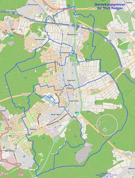
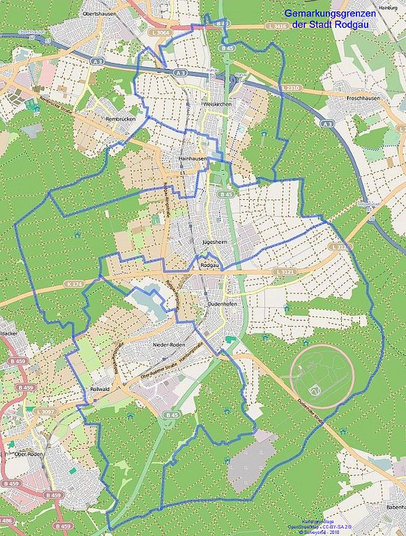
Deutsch: Kartengrafik mit den Gemarkungsgrenzen der Stadt Rodgau |
| Date | |
| Source | Eigene Grafik, erstellt aus Daten von OpenStreetMap - Veröffentlicht unter CC-BY-SA 2.0 und eigenen Rescherschen |
| Author | Surveyor54 - 2010-12-28 |
| Other versions | File:Gemarkungsgrenzen_Rodgau.png |
OpenStreetMap - Veröffentlicht unter CC-BY-SA 2.0
Licensing
edit
R.Raab, the copyright holder of this work, hereby publishes it under the following license:

|
The copyright holder of this file, R.Raab, allows anyone to use it for any purpose, provided that the copyright holder is properly attributed. Redistribution, derivative work, commercial use, and all other use is permitted. |
|
|
File history
Click on a date/time to view the file as it appeared at that time.
| Date/Time | Thumbnail | Dimensions | User | Comment | |
|---|---|---|---|---|---|
| current | 14:23, 28 December 2010 | | 1,200 × 1,582 (528 KB) | Surveyor54 (talk | contribs) | {{Information |Description={{de|1=Kartengrafik mit den Gemarkungsgrenzen der Stadt Rodgau}} |Source=Eigene Grafik, erstellt aus Daten von OpenStreetMap - Veröffentlicht unter CC-BY-SA 2.0 und eigenen Rescherschen |Author=Surveyor54 - 2010-12-28 |Date=2 |
You cannot overwrite this file.
File usage on Commons
The following 2 pages use this file:
File usage on other wikis
The following other wikis use this file:
- Usage on azb.wikipedia.org