File:Gemeenten lijnen 1440px.png

Size of this preview: 497 × 600 pixels. Other resolutions: 199 × 240 pixels | 398 × 480 pixels | 637 × 768 pixels | 849 × 1,024 pixels | 1,400 × 1,689 pixels.
Original file (1,400 × 1,689 pixels, file size: 281 KB, MIME type: image/png)
Captions
Captions
Add a one-line explanation of what this file represents
Summary
edit
| Description |
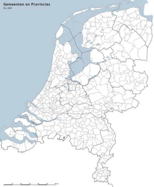
Nederlands: Nederlandse gemeenten, situatie 2007 en 2008. |
| Date |
(original upload date) |
| Source |
Transferred from nl.wikipedia; transfered to Commons by User:GijsvdL using CommonsHelper.
|
| Author |
Jan-Willem van Aalst Original uploader was Janwillemvanaalst at nl.wikipedia |
| Permission (Reusing this file) |
CC-BY-SA-2.5. |
Licensing
edit
Jan-Willem van Aalst, the copyright holder of this work, hereby publishes it under the following license:
This file is licensed under the Creative Commons Attribution-Share Alike 2.5 Generic license.
Attribution: Jan-Willem van Aalst
- You are free:
- to share – to copy, distribute and transmit the work
- to remix – to adapt the work
- Under the following conditions:
- attribution – You must give appropriate credit, provide a link to the license, and indicate if changes were made. You may do so in any reasonable manner, but not in any way that suggests the licensor endorses you or your use.
- share alike – If you remix, transform, or build upon the material, you must distribute your contributions under the same or compatible license as the original.
Original upload log
edit
The original description page was here. All following user names refer to nl.wikipedia.
- 2008-05-25 11:33 Janwillemvanaalst 1440×1760×8 (363253 bytes) {{Information |Description=Nederlandse gemeenten, situatie 2007 en 2008. |Source=Jan-Willem van Aalst, samengesteld uit publiek beschibkare geo-data: * Referentie-ondergrond (kustlijn, rivieren) gerasterd uit de OpenStreet Map OSM. (http://www.openstreet
File history
Click on a date/time to view the file as it appeared at that time.
| Date/Time | Thumbnail | Dimensions | User | Comment | |
|---|---|---|---|---|---|
| current | 18:57, 21 January 2009 | | 1,400 × 1,689 (281 KB) | Janwillemvanaalst (talk | contribs) | {{Information |Description=Nederlandse gemeenten 2009 |Source=Eigen werk, grenzen ter beschikking gesteld door brandweerregio's |Date=21 januari 2009 |Author=Jan-Willem van Aalst |Permission= |other_versions= }} |
| 19:47, 25 May 2008 |  | 1,440 × 1,760 (308 KB) | Erik Baas (talk | contribs) | Ongewenste teksten en kader verwijderd. | |
| 12:55, 25 May 2008 |  | 1,440 × 1,760 (355 KB) | File Upload Bot (Magnus Manske) (talk | contribs) | {{BotMoveToCommons|nl.wikipedia}} {{Information |Description={{nl|Nederlandse gemeenten, situatie 2007 en 2008.}} |Source=Transferred from [http://nl.wikipedia.org nl.wikipedia]; transfered to Commons by User:GijsvdL using [http://tools.wikimedia.de/ |
You cannot overwrite this file.
File usage on Commons
The following 2 pages use this file: