File:Gemeinden in HR.svg

Size of this PNG preview of this SVG file: 628 × 600 pixels. Other resolutions: 251 × 240 pixels | 503 × 480 pixels | 804 × 768 pixels | 1,072 × 1,024 pixels | 2,144 × 2,048 pixels | 692 × 661 pixels.
Original file (SVG file, nominally 692 × 661 pixels, file size: 386 KB)
Captions
Captions
Add a one-line explanation of what this file represents
Summary
edit
| Description |
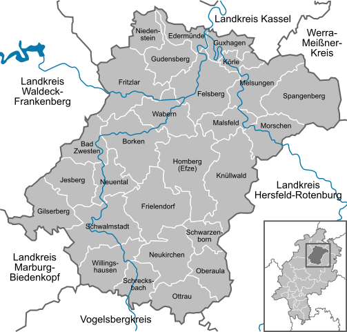
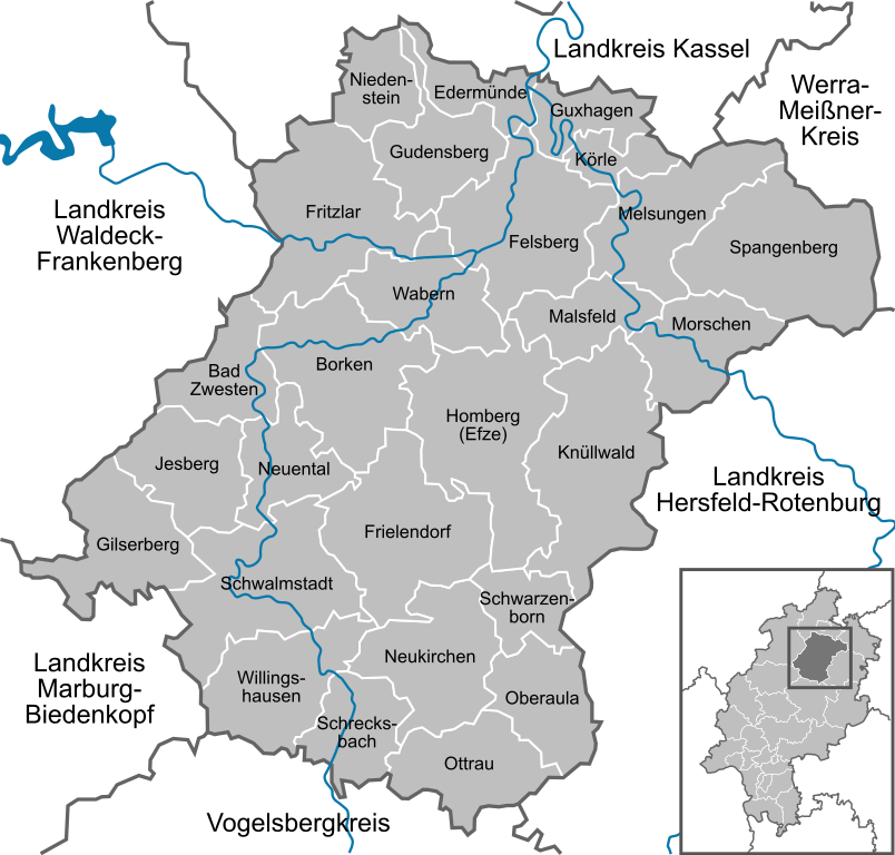
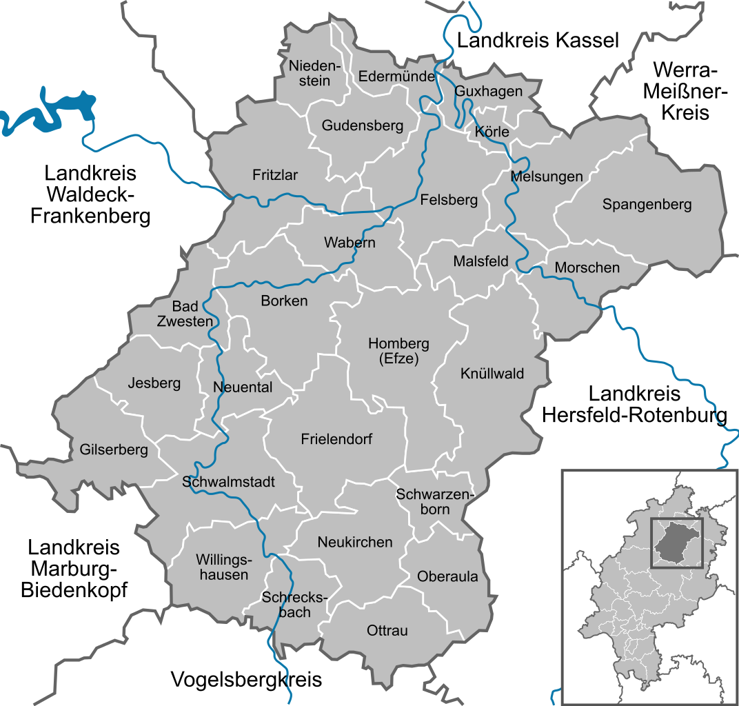
Deutsch: Karte der Gemeinden im Schwalm-Eder-Kreis
English: Map of the municipalities in district Schwalm-Eder-Kreis |
| Date | 12.11.2008 |
| Source | Own work, using File:Hesse location map.svg by TUBS |
| Author | NordNordWest |
| Other versions | Derivative works of this file: Location map of the scope of the Rhein-Main-Verkehrsverbund.svg |

|
This map has been made or improved in the German Kartenwerkstatt (Map Lab). You can propose maps to improve as well.
|
Licensing
edit
I, the copyright holder of this work, hereby publish it under the following licenses:

|
Permission is granted to copy, distribute and/or modify this document under the terms of the GNU Free Documentation License, Version 1.2 or any later version published by the Free Software Foundation; with no Invariant Sections, no Front-Cover Texts, and no Back-Cover Texts. A copy of the license is included in the section entitled GNU Free Documentation License. |
This file is licensed under the Creative Commons Attribution-Share Alike 3.0 Unported license.
- You are free:
- to share – to copy, distribute and transmit the work
- to remix – to adapt the work
- Under the following conditions:
- attribution – You must give appropriate credit, provide a link to the license, and indicate if changes were made. You may do so in any reasonable manner, but not in any way that suggests the licensor endorses you or your use.
- share alike – If you remix, transform, or build upon the material, you must distribute your contributions under the same or compatible license as the original.
You may select the license of your choice.
File history
Click on a date/time to view the file as it appeared at that time.
| Date/Time | Thumbnail | Dimensions | User | Comment | |
|---|---|---|---|---|---|
| current | 22:22, 17 September 2010 | | 692 × 661 (386 KB) | NordNordWest (talk | contribs) | upd |
| 20:54, 12 November 2008 |  | 692 × 661 (88 KB) | NordNordWest (talk | contribs) | {{Information |Description= {{de|Karte der Gemeinden im Schwalm-Eder-Kreis}} {{en|Map of the municipalities in district Schwalm-Eder-Kreis}} |Source=own work |Date=12.11.2008 |Author=[[User:NordNordWes |
You cannot overwrite this file.
File usage on Commons
There are no pages that use this file.
File usage on other wikis
The following other wikis use this file:
- Usage on ceb.wikipedia.org
- Usage on da.wikipedia.org
- Usage on de.wikipedia.org
- Usage on en.wikipedia.org
- Usage on es.wikipedia.org
- Usage on fi.wikipedia.org
- Usage on hr.wikipedia.org
- Usage on id.wikipedia.org
- Usage on it.wikipedia.org
- Usage on ja.wikipedia.org
- Usage on ku.wikipedia.org
- Usage on lb.wikipedia.org
- Usage on ms.wikipedia.org
- Usage on no.wikipedia.org
- Usage on tr.wikipedia.org
- Usage on uk.wikipedia.org
- Usage on vi.wikipedia.org
- Usage on www.wikidata.org