File:General land use, Flat Bayou, portion of the Plum Bayou Watershed, Jefferson County, Arkansas LOC 85693534.jpg

Size of this preview: 331 × 599 pixels. Other resolutions: 132 × 240 pixels | 265 × 480 pixels | 424 × 768 pixels | 565 × 1,024 pixels | 1,131 × 2,048 pixels | 3,279 × 5,937 pixels.
Original file (3,279 × 5,937 pixels, file size: 1.55 MB, MIME type: image/jpeg)
Captions
Captions
Add a one-line explanation of what this file represents
Summary edit
| Description |
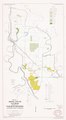
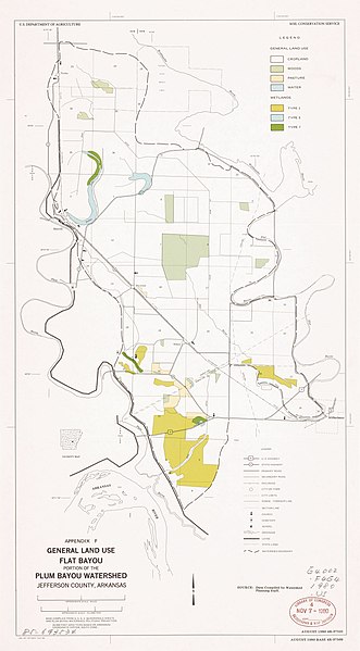
English: Shows cropland, woods, pasture, and types of wetlands. At head of title: Appendix F. "August 1980 4R-37521. August 1980 Base 4 R-37509." "Base compiled from U.S.G.S. quadrangle sheets and Plum Bayou Watershed." "Source: Data compiled by Watershed Planning Staff." "20,000 foot grid ticks based on Arkansas Coordinate System, South Zone." Includes location map. Available also through the Library of Congress Web site as a raster image. |
||
| Title | General land use, Flat Bayou, portion of the Plum Bayou Watershed, Jefferson County, Arkansas | ||
| Shelf ID | G4002.F6G4 1980 .U5 | ||
| Date | |||
| Source | https://www.loc.gov/item/85693534/ | ||
| Author | United States. Soil Conservation Service | ||
| Permission (Reusing this file) |
|
||
| Other versions |
|
||
| Location | United States · Flat Bayou Watershed. · Flat Bayou Watershed · Arkansas | ||
| Part of | American Memory · Catalog · Geography And Map Division · Additional Conservation And Environment Cartographic Items | ||
| Subject | Wetlands · Land Use · Flat Bayou Watershed · United States · Maps · Arkansas |

Licensing edit
| This work is from the Library of Congress. According to the library, there are no known copyright restrictions on the use of this work. |  |
File history
Click on a date/time to view the file as it appeared at that time.
| Date/Time | Thumbnail | Dimensions | User | Comment | |
|---|---|---|---|---|---|
| current | 16:57, 25 January 2019 | | 3,279 × 5,937 (1.55 MB) | Fæ (talk | contribs) | LOC Maps https://www.loc.gov/item/85693534/ #27102 |
You cannot overwrite this file.
File usage on Commons
The following page uses this file: