File:Generalkarta Wenern.png

Size of this preview: 516 × 599 pixels. Other resolutions: 207 × 240 pixels | 413 × 480 pixels | 661 × 768 pixels | 882 × 1,024 pixels | 1,764 × 2,048 pixels | 2,596 × 3,014 pixels.
Original file (2,596 × 3,014 pixels, file size: 15.85 MB, MIME type: image/png)
Captions
Captions
Add a one-line explanation of what this file represents
Summary
edit
| Description |
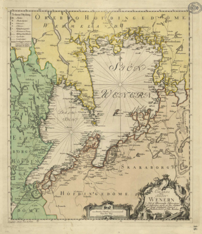
Svenska: Generalkarta över sjön Vänern med omgivning, skapad 1773 av Nils Marelius för Kungliga Lantmäteriet. |
| Date | |
| Source | The Swedish National Land Survey's database with historical maps |
| Author | Kungl. Lantmäteriets Generalkartor |
Licensing
edit
|
This work is in the public domain in its country of origin and other countries and areas where the copyright term is the author's life plus 100 years or fewer. | |
| This file has been identified as being free of known restrictions under copyright law, including all related and neighboring rights. | |
File history
Click on a date/time to view the file as it appeared at that time.
| Date/Time | Thumbnail | Dimensions | User | Comment | |
|---|---|---|---|---|---|
| current | 14:09, 15 September 2017 | | 2,596 × 3,014 (15.85 MB) | Moralist (talk | contribs) | Made the map straighter |
| 21:52, 14 September 2017 |  | 2,750 × 3,266 (12.04 MB) | Moralist (talk | contribs) | VicuñaUploader 1.23 |
You cannot overwrite this file.
File usage on Commons
There are no pages that use this file.