File:Genova mappa rete filoviaria 2008.svg

Size of this PNG preview of this SVG file: 800 × 555 pixels. Other resolutions: 320 × 222 pixels | 640 × 444 pixels | 1,024 × 710 pixels | 1,280 × 888 pixels | 2,560 × 1,776 pixels | 1,051 × 729 pixels.
Original file (SVG file, nominally 1,051 × 729 pixels, file size: 4.63 MB)
Captions
Captions
Add a one-line explanation of what this file represents
Summary
edit
| Description |
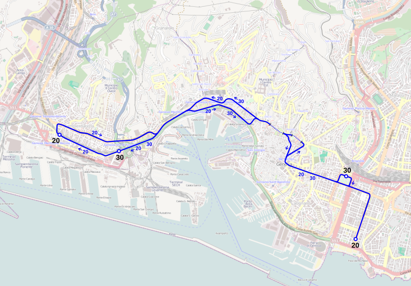
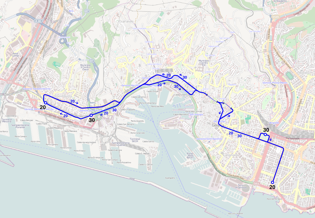
English: Map of the trolleybus network of Genoa after the changes of 2008.
Italiano: Mappa della rete filoviaria di Genova dopo le modifiche del 2008. |
|||
| Date | (see file history) | |||
| Source | openstreetmap.org | |||
| Creator |
OpenStreetMap contributors |
|||
| Permission (Reusing this file) |
OpenStreetMap data is available under the Open Database License (details). Map tiles are licensed under the Creative Commons Attribution-ShareAlike 2.0 license (CC-BY-SA 2.0).
This file is licensed under the Creative Commons Attribution-Share Alike 2.0 Generic license.
|
|||
| Georeferencing | If inappropriate please set warp_status = skip to hide. |
File history
Click on a date/time to view the file as it appeared at that time.
| Date/Time | Thumbnail | Dimensions | User | Comment | |
|---|---|---|---|---|---|
| current | 21:01, 19 August 2013 | | 1,051 × 729 (4.63 MB) | Arbalete (talk | contribs) | {{Information |Description ={{en|1=Map of the trolleybus network of Genoa.}} {{it|1=Mappa della rete filoviaria di Genova.}} |Source ={{own}} |Author =Friedrichstrasse |Date = |Permission = |ot... |
You cannot overwrite this file.
File usage on Commons
There are no pages that use this file.