File:Geological mapping.gif
No higher resolution available.
Geological_mapping.gif (300 × 320 pixels, file size: 29 KB, MIME type: image/gif)
Captions
Captions
Add a one-line explanation of what this file represents
Summary
edit
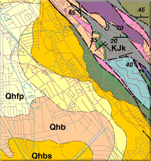
| Description | geological mapping example |
| Date | |
| Source | http://www.nature.nps.gov/geology/usgsnps/gmap/gmap1.html |
| Author |
Licensing
edit
This image is in the public domain in the United States because it only contains materials that originally came from the United States Geological Survey, an agency of the United States Department of the Interior. For more information, see the official USGS copyright policy.
|
File history
Click on a date/time to view the file as it appeared at that time.
| Date/Time | Thumbnail | Dimensions | User | Comment | |
|---|---|---|---|---|---|
| current | 13:15, 26 January 2011 | | 300 × 320 (29 KB) | דקי (talk | contribs) |
You cannot overwrite this file.
File usage on Commons
The following page uses this file:
File usage on other wikis
The following other wikis use this file:
- Usage on he.wikipedia.org
- Usage on hy.wikipedia.org