File:Georges.jpg

Size of this preview: 800 × 385 pixels. Other resolutions: 320 × 154 pixels | 948 × 456 pixels.
Original file (948 × 456 pixels, file size: 105 KB, MIME type: image/jpeg)
Captions
Captions
Add a one-line explanation of what this file represents
Summary
edit
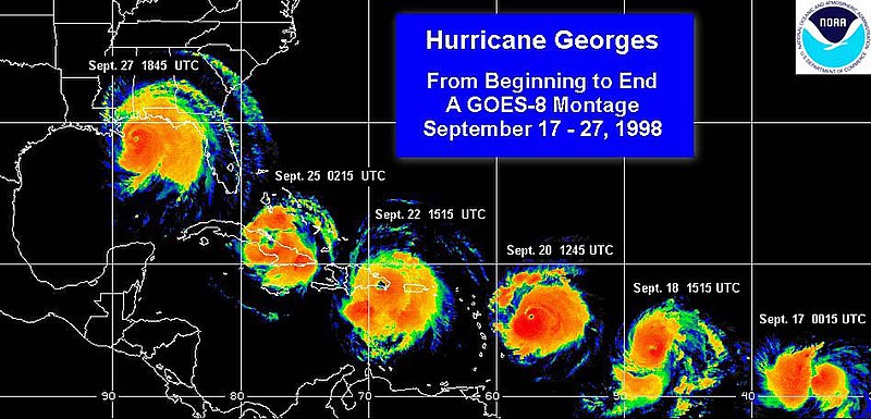
| Description | This image shows satellite pictures of Hurricane Georges throughout its lifetime as it moved through the Atlantic Ocean, Caribbean Sea, and Gulf of Mexico. |
| Source | [1] |
| Author | National Oceanic and Atmospheric Administration |
Licensing
edit
This image is in the public domain because it contains materials that originally came from the U.S. National Oceanic and Atmospheric Administration, taken or made as part of an employee's official duties.
|
Original upload log
edit
The original description page was here. All following user names refer to en.wikipedia.
| Date/Time | Dimensions | User | Comment |
|---|---|---|---|
| 2005-09-22 06:35:31 | 948 × 456 | Wepaman | Hurricane Georges 1998 |
File history
Click on a date/time to view the file as it appeared at that time.
| Date/Time | Thumbnail | Dimensions | User | Comment | |
|---|---|---|---|---|---|
| current | 02:53, 2 November 2020 | | 948 × 456 (105 KB) | FSock (talk | contribs) | Transferred from en.wikipedia (MTC!) (1.1.1) |
You cannot overwrite this file.
File usage on Commons
There are no pages that use this file.