File:Geothermie piton des neiges.jpg
Size of this preview: 800 × 486 pixels. Other resolutions: 320 × 194 pixels | 640 × 389 pixels | 1,024 × 622 pixels | 1,352 × 821 pixels.
Original file (1,352 × 821 pixels, file size: 104 KB, MIME type: image/jpeg)
Captions
Captions
Add a one-line explanation of what this file represents
Summary
edit
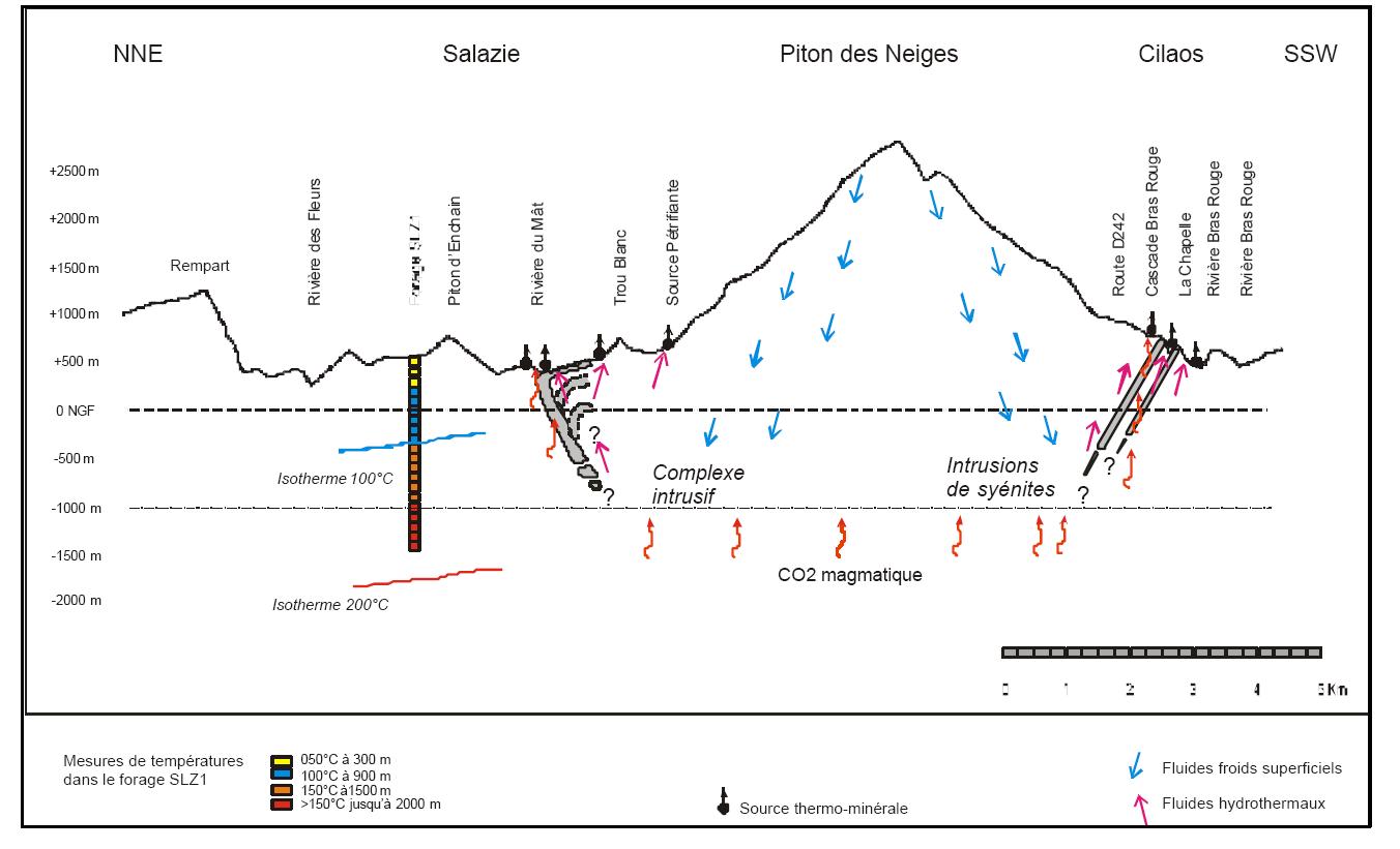
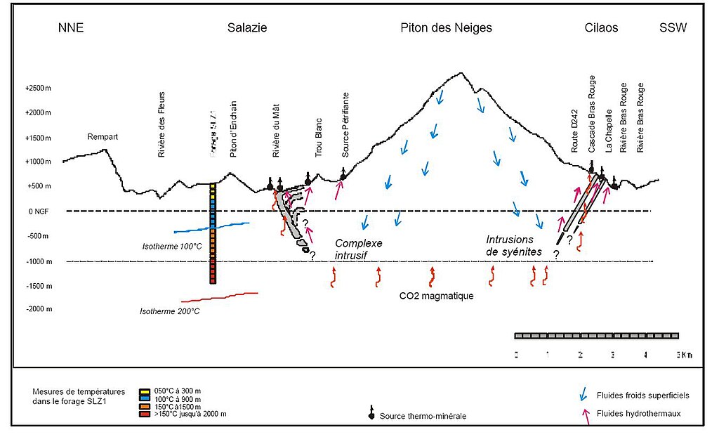
| Description |
Modèle conceptuel du système géothermique proposé, au droit des cirques de Salazie et de Cilaos (d’après BRGM, 2001) |
| Date | |
| Source | synthèse rencontre géothermie 2005 |
| Author | Dunog |
| Camera location | | View this and other nearby images on: OpenStreetMap |
|---|
Licensing
edit
| I, the copyright holder of this work, release this work into the public domain. This applies worldwide. In some countries this may not be legally possible; if so: I grant anyone the right to use this work for any purpose, without any conditions, unless such conditions are required by law. |
File history
Click on a date/time to view the file as it appeared at that time.
| Date/Time | Thumbnail | Dimensions | User | Comment | |
|---|---|---|---|---|---|
| current | 09:43, 31 January 2008 | | 1,352 × 821 (104 KB) | Dunog (talk | contribs) | {{Information |Description= Modèle conceptuel du système géothermique proposé, au droit des cirques de Salazie et de Cilaos (d’après BRGM, 2001) |Source= synthse rencontre geothermie 2005 |Date= juin 2005 |Author= |Permission= |other_versions= }} |
You cannot overwrite this file.
File usage on Commons
There are no pages that use this file.
File usage on other wikis
The following other wikis use this file:
- Usage on fr.wikipedia.org