File:Geotop Heidelberger Schloßgraben.jpg

Size of this preview: 800 × 600 pixels. Other resolutions: 320 × 240 pixels | 640 × 480 pixels | 1,024 × 768 pixels | 1,280 × 960 pixels | 2,560 × 1,920 pixels | 3,648 × 2,736 pixels.
Original file (3,648 × 2,736 pixels, file size: 1.93 MB, MIME type: image/jpeg)
Captions
Captions
Add a one-line explanation of what this file represents
Summary
edit
| Description |
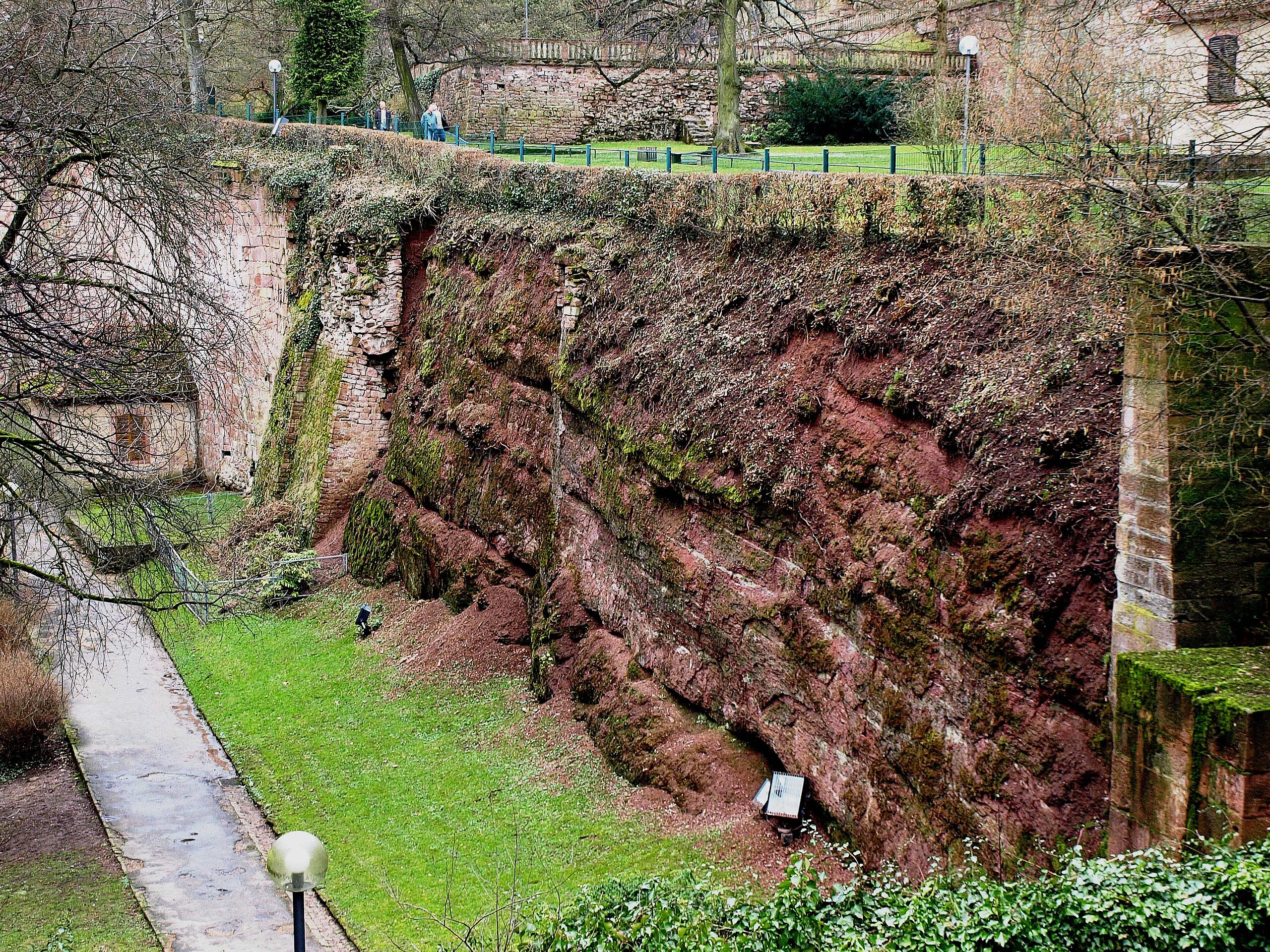
Deutsch: Geologischer Aufschluss im Heidelberger Schloßgraben. An der Südwand zwischen Krautturm und Brückenhaus zeigt sich ein einzigartiges Profil, das die Grenze vom paläozoischen Grundgebirge zum permischen Deckgebirge offenbart.[1] |
| Date | |
| Source | Own work |
| Author | Michael Linnenbach |
| Permission (Reusing this file) |
User:1971markus/No Facebook |
Licensing
edit
I, the copyright holder of this work, hereby publish it under the following license:
This file is licensed under the Creative Commons Attribution-Share Alike 4.0 International license.
- You are free:
- to share – to copy, distribute and transmit the work
- to remix – to adapt the work
- Under the following conditions:
- attribution – You must give appropriate credit, provide a link to the license, and indicate if changes were made. You may do so in any reasonable manner, but not in any way that suggests the licensor endorses you or your use.
- share alike – If you remix, transform, or build upon the material, you must distribute your contributions under the same or compatible license as the original.
- ↑ Schöttle, Manfred: Geologische Naturdenkmale im Regierungsbezirk Karlsruhe. Eine Zusammenstellung geschützter und schutzwürdiger geologischer Objekte. In: Beih. Veröff. Naturschutz Landschaftspflege Bad. Württ. Band 38, 1984, Karlsruhe.
File history
Click on a date/time to view the file as it appeared at that time.
| Date/Time | Thumbnail | Dimensions | User | Comment | |
|---|---|---|---|---|---|
| current | 10:56, 10 October 2023 | | 3,648 × 2,736 (1.93 MB) | Michael Linnenbach (talk | contribs) | Uploaded own work with UploadWizard |
You cannot overwrite this file.
File usage on Commons
There are no pages that use this file.
File usage on other wikis
The following other wikis use this file:
- Usage on de.wikipedia.org