File:Germany 1-25,000. LOC 2008625027-1.tif

Size of this JPG preview of this TIF file: 697 × 599 pixels. Other resolutions: 279 × 240 pixels | 558 × 480 pixels | 893 × 768 pixels | 1,191 × 1,024 pixels | 2,381 × 2,048 pixels | 9,155 × 7,874 pixels.
Original file (9,155 × 7,874 pixels, file size: 206.24 MB, MIME type: image/tiff)
Captions
Captions
Add a one-line explanation of what this file represents
Summary edit
| Description |
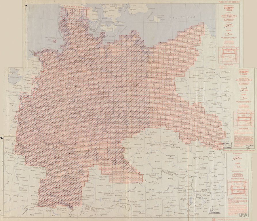
English: Relief shown by contours, shading, hachures, and spot heights. Relief shown by gradient tints on special layered edition sheets. Depths shown by form lines on some sheets. Legend in German, English, and French on verso of some sheets. Includes various issues. Later sheets published by D. Survey, War Office and Air Ministry. On some sheets: AMS M 841. Some maps printed on verso of pre-existing surplus stock. Some sheets include index to adjoining sheets and reliability diagram. Text and index map on verso of sheet 3655. Some sheets overprinted in red ink showing administrative boundaries. Sheets numbered 0519, 1620, 3208, 4025, etc. Available also through the Library of Congress Web site as a raster image. Includes some duplicate sheets. |
||
| Title | Germany 1:25,000. | ||
| Shelf ID | G6080 s25 .G7 | ||
| Parent | https://www.loc.gov/resource/g6080m.gct00113b/ | ||
| Sheet title | Index Map | ||
| Date | |||
| Source | https://www.loc.gov/item/2008625027/ | ||
| Author | Great Britain. War Office. General Staff. Geographical Section | ||
| Permission (Reusing this file) |
|
||
| Other versions |
|
||
| Location | Germany | ||
| Part of | American Memory · General Maps · Catalog · Geography And Map Division | ||
| Subject | Germany · Maps, Topographic |


Licensing edit
This work is in the public domain in the United States because it is a work prepared by an officer or employee of the United States Government as part of that person’s official duties under the terms of Title 17, Chapter 1, Section 105 of the US Code.
Note: This only applies to original works of the Federal Government and not to the work of any individual U.S. state, territory, commonwealth, county, municipality, or any other subdivision. This template also does not apply to postage stamp designs published by the United States Postal Service since 1978. (See § 313.6(C)(1) of Compendium of U.S. Copyright Office Practices). It also does not apply to certain US coins; see The US Mint Terms of Use.
|
 | |
| This file has been identified as being free of known restrictions under copyright law, including all related and neighboring rights. | ||
File history
Click on a date/time to view the file as it appeared at that time.
| Date/Time | Thumbnail | Dimensions | User | Comment | |
|---|---|---|---|---|---|
| current | 17:35, 29 August 2018 |  | 9,155 × 7,874 (206.24 MB) | Fæ (talk | contribs) | LOC Maps multisheet https://www.loc.gov/item/2008625027/ sheet 1 of 37 #20816 |
You cannot overwrite this file.
File usage on Commons
The following page uses this file: