File:Germany icehockey oberliga.svg

Size of this PNG preview of this SVG file: 506 × 600 pixels. Other resolutions: 202 × 240 pixels | 405 × 480 pixels | 648 × 768 pixels | 864 × 1,024 pixels | 1,728 × 2,048 pixels | 1,073 × 1,272 pixels.
Original file (SVG file, nominally 1,073 × 1,272 pixels, file size: 705 KB)
Captions
Captions
Add a one-line explanation of what this file represents
Summary edit
| Description |
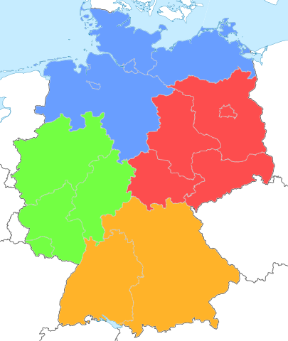
Deutsch: Positionskarte von Deutschland mit Färbung der Eishockey-Oberligen ab 2010 Quadratische Plattkarte, N-S-Streckung 150 %. Geographische Begrenzung der Karte: |
||
| Date | |||
| Source | Basierend auf http://de.wikipedia.org/wiki/Datei:Germany_location_map.svg von NordNordWest | ||
| Author | Tommes (Roter Frosch)at de.wikipedia | ||
| Permission (Reusing this file) |
I, the copyright holder of this work, hereby publish it under the following licenses:
This file is licensed under the Creative Commons Attribution-Share Alike 3.0 Unported license.
You may select the license of your choice. |
||
| Other versions | Derivative works of this file: Germany Eishockey Regionalliga 2012.svg |

Original upload log edit
Transferred from de.wikipedia to Commons by Akkakk.
The original description page was here. All following user names refer to de.wikipedia.
- 2010-04-01 15:02 Tommes (Roter Frosch) 1073×1272× (707272 bytes)
{{Information |Beschreibung = Germany location map.svg Positionskarte von Deutschland mit Färbung der Eishockey-Oberligen ab 2010 Quadratische Plattkarte, N-S-Streckung 150 %. Geographische Begrenzung der Karte: N: 55.1° N S: 47.2° N W: 5.5° O O:
File history
Click on a date/time to view the file as it appeared at that time.
| Date/Time | Thumbnail | Dimensions | User | Comment | |
|---|---|---|---|---|---|
| current | 20:27, 7 July 2012 | | 1,073 × 1,272 (705 KB) | Tommes (talk | contribs) | {{Information |Description={{de|Färbung der Gebiete verfeinert und gemäß Einteilung der Eishockey-Oberligen ab 2010 geändert (nach regionalen Logo-Farben) }}}} |
| 19:39, 8 April 2012 |  | 1,073 × 1,272 (691 KB) | Funfood (talk | contribs) | Reverted to version as of 19:26, 31 July 2011 | |
| 18:58, 8 April 2012 |  | 505 × 600 (41 KB) | Tommes (talk | contribs) | kleine Fehler bei der Einfärbung des Norgebietes behoben (Sylt, Darß, etc. | |
| 19:26, 31 July 2011 |  | 1,073 × 1,272 (691 KB) | Akkakk (talk | contribs) | {{Information |Description={{de|Positionskarte von Deutschland mit Färbung der Eishockey-Oberligen ab 2010<br /> Quadratische Plattkarte, N-S-Streckung 150 %. Geographische Begrenzung der Karte:</br> N: 55.1° N<br /> S: 47.2° N<br /> W: 5.5° O<br /> |
You cannot overwrite this file.
File usage on Commons
The following page uses this file:
File usage on other wikis
The following other wikis use this file:
- Usage on de.wikipedia.org
- Usage on fr.wikipedia.org