File:Gettysburg Day2 Wheatfield1.png
Size of this preview: 800 × 600 pixels. Other resolutions: 320 × 240 pixels | 640 × 480 pixels | 1,024 × 768 pixels | 1,280 × 960 pixels | 2,560 × 1,920 pixels | 4,800 × 3,600 pixels.
Original file (4,800 × 3,600 pixels, file size: 9.56 MB, MIME type: image/png)
Captions
Captions
Add a one-line explanation of what this file represents
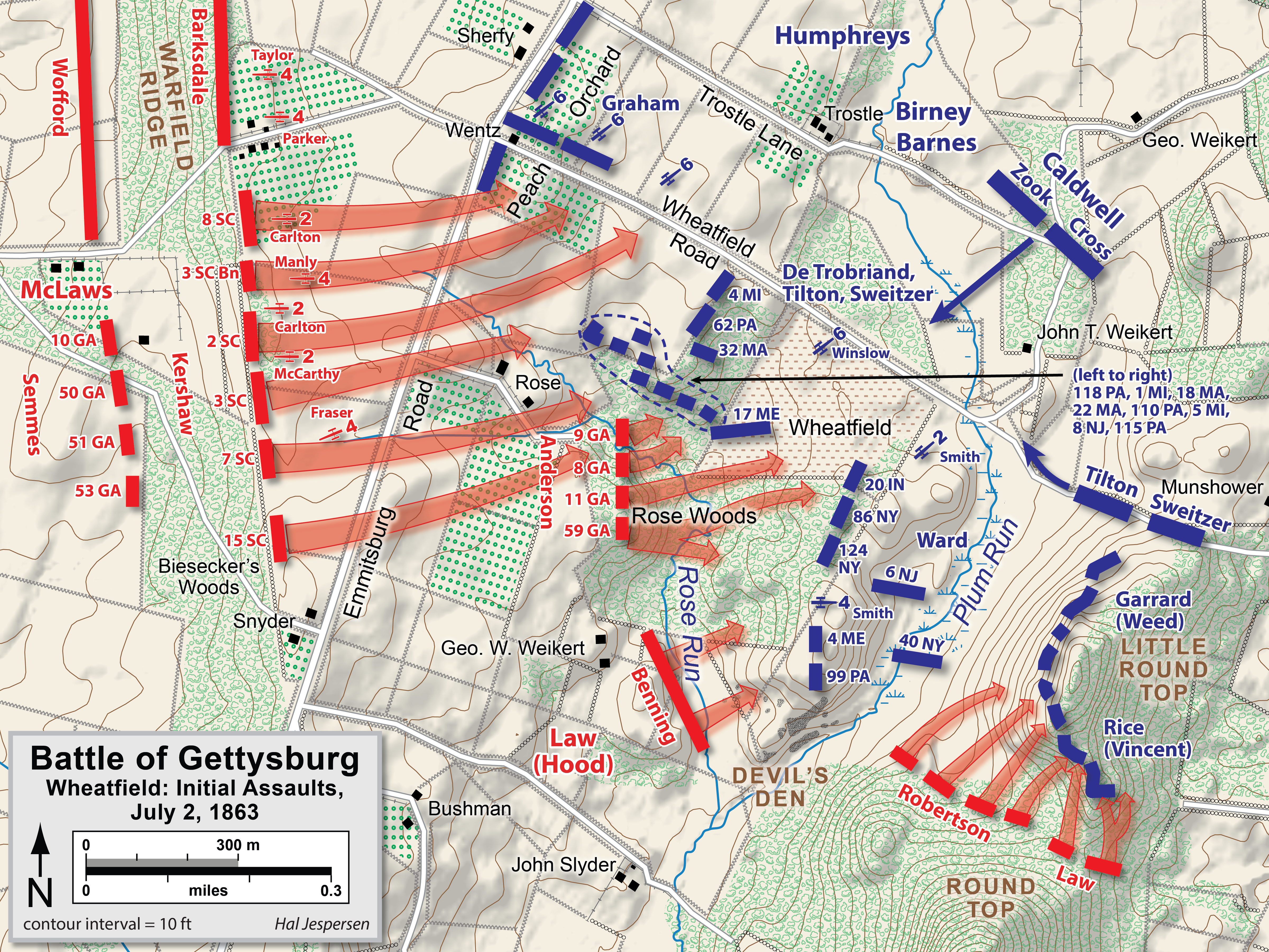
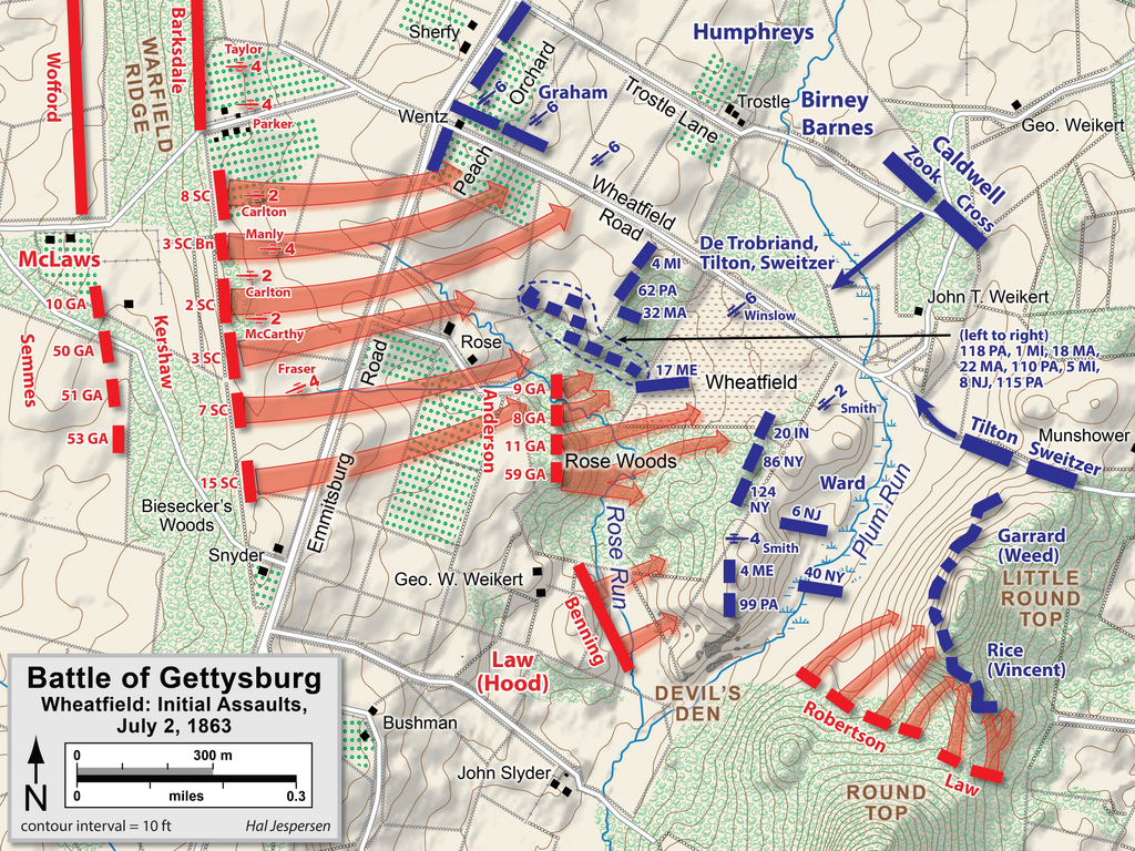
| Description | Map of Wheatfield actions in the Battle of Gettysburg, Second Day, of the American Civil War. Updated unit positions and made topographical background consistent with many other Wikipedia Gettysburg maps. Drawn in Adobe Illustrator CS5 by Hal Jespersen. Graphic source file is available at http://www.posix.com/CWmaps/ |
| Date | |
| Source | Own work |
| Author | Hal Jespersen |
This file is licensed under the Creative Commons Attribution 3.0 Unported license.
Attribution: Map by Hal Jespersen, www.posix.com/CW
- You are free:
- to share – to copy, distribute and transmit the work
- to remix – to adapt the work
- Under the following conditions:
- attribution – You must give appropriate credit, provide a link to the license, and indicate if changes were made. You may do so in any reasonable manner, but not in any way that suggests the licensor endorses you or your use.
File history
Click on a date/time to view the file as it appeared at that time.
| Date/Time | Thumbnail | Dimensions | User | Comment | |
|---|---|---|---|---|---|
| current | 17:39, 3 February 2023 | | 4,800 × 3,600 (9.56 MB) | Hlj (talk | contribs) | improved graphics and detail |
| 20:03, 2 April 2011 |  | 2,449 × 1,789 (1.21 MB) | Hlj (talk | contribs) | Updated graphical format of rivers and roads. Same license. | |
| 00:04, 31 July 2010 |  | 2,449 × 1,789 (1.17 MB) | Hlj (talk | contribs) | New version improves accuracy of unit positions and graphic style that matches others in the Gettysburg series. Added legend box. Drawn by Hal Jespersen in Adobe Illustrator CS5. Graphic source file is available at http://www.posix.com/CWmaps/ {{cc-by-3.0 | |
| 18:33, 10 July 2010 |  | 2,449 × 1,789 (1.17 MB) | Hlj (talk | contribs) | {{Information |Description=Map of Little Round Top (Battle of Gettysburg) of the American Civil War. Updated unit positions and made topographical background consistent with many other Wikipedia Gettysburg maps. Drawn in Adobe Illustrator CS5 by Hal J | |
| 14:15, 16 November 2006 |  | 1,483 × 1,203 (510 KB) | Rheo1905~commonswiki (talk | contribs) | This map is made by en:User:Hlj. 1863. 7. 2. Gettysburg Second Day, Battle of Wheatfield (1) {{PD-release}} |
You cannot overwrite this file.
File usage on Commons
The following page uses this file:
File usage on other wikis
The following other wikis use this file:
- Usage on cs.wikipedia.org
- Usage on da.wikipedia.org
- Usage on en.wikipedia.org
- Usage on hu.wikipedia.org
- Usage on ko.wikipedia.org
- Usage on ru.wikipedia.org
- Usage on zh.wikipedia.org