File:Ghadschar.png

No higher resolution available.
Ghadschar.png (759 × 591 pixels, file size: 286 KB, MIME type: image/png)
Captions
Captions
Add a one-line explanation of what this file represents
Summary edit
| Description |
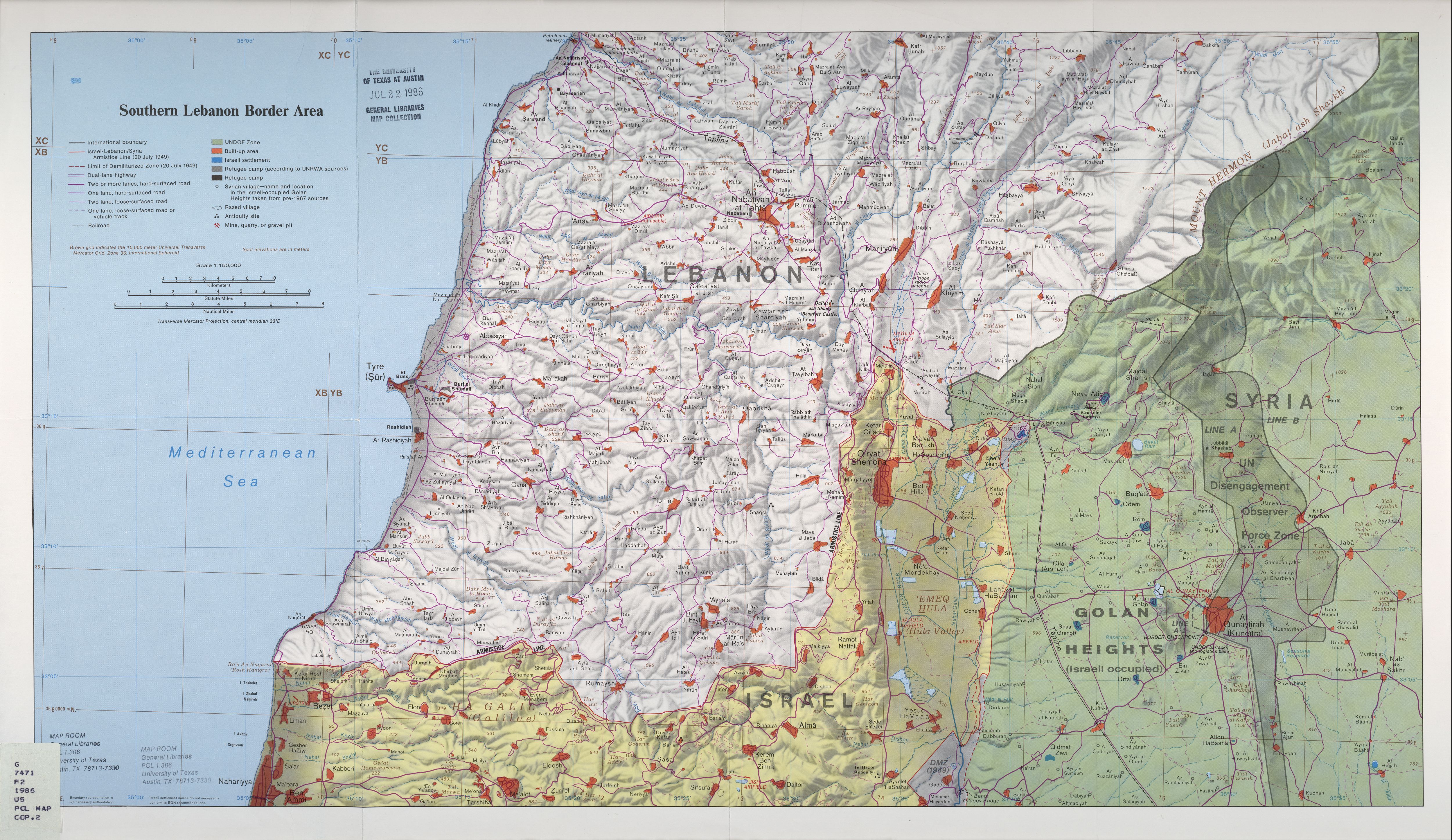
Deutsch: Lage des Grenzortes Ghadschar an der Blauen Linie zwischen Libanon und den von israel annektierten Golanhöhen |
| Date | (crop) |
| Source | http://www.lib.utexas.edu/maps/middle_east_and_asia/lebanon_southern_border_1986.jpg |
| Author | U.S. Central Intelligence Agency, cropped by Matthiasb at de.wikipedia |
Licensing edit
| This image is a work of a Central Intelligence Agency employee, taken or made as part of that person's official duties. As a Work of the United States Government, this image or media is in the public domain in the United States.
|

|
File history
Click on a date/time to view the file as it appeared at that time.
| Date/Time | Thumbnail | Dimensions | User | Comment | |
|---|---|---|---|---|---|
| current | 12:22, 4 February 2008 | | 759 × 591 (286 KB) | Matthiasb (talk | contribs) | {{Information |Description={{de|Lage des Grenzortes Ghadschar an der Blauen Linie zwischen Libanon und den von israel annektierten Golanhöhen}} |Source=Transferred from [http://de.wikipedia.org de.wikipedia]<br/> (Original text : ''http://www.lib.utexas. |
You cannot overwrite this file.
File usage on Commons
There are no pages that use this file.
File usage on other wikis
The following other wikis use this file:
- Usage on de.wikipedia.org
- Usage on de.wikinews.org