File:Giri 2010-10-22 0655Z.jpg

Size of this preview: 461 × 599 pixels. Other resolutions: 184 × 240 pixels | 369 × 480 pixels | 591 × 768 pixels | 788 × 1,024 pixels | 1,575 × 2,048 pixels | 4,000 × 5,200 pixels.
Original file (4,000 × 5,200 pixels, file size: 3.92 MB, MIME type: image/jpeg)
Captions
Captions
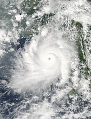
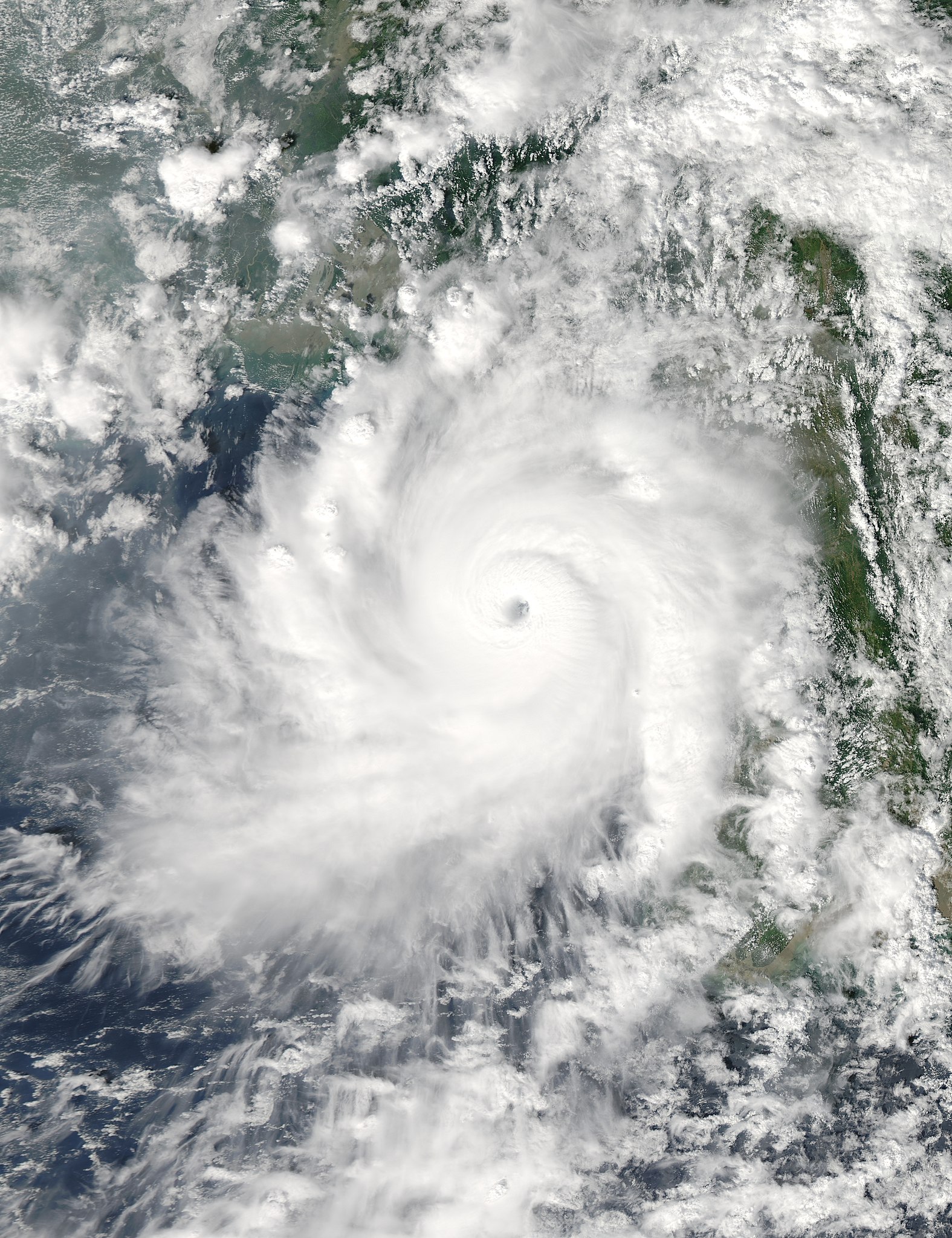
BAY OF BENGAL SUPER CYCLONE
Summary
edit| Description |
English: This image, taken by the Moderate Resolution Imaging Spectroradiometer (MODIS) on NASA’s Aqua satellite, shows Very Severe Cyclonic Storm Giri moving ashore over Myanmar (Burma) at 1:25 p.m. local time (06:55 UTC) on October 22, 2010. It shows a compact, mature storm with a well-defined eye and a circular shape. |
| Date | |
| Source | http://earthobservatory.nasa.gov/NaturalHazards/view.php?id=46489 |
| Author | NASA image courtesy Jeff Schmaltz, MODIS Rapid Response Team at NASA GSFC |
| Other versions |
|

| Camera location | | View this and other nearby images on: OpenStreetMap |
|---|
Licensing
edit
| This file is in the public domain in the United States because it was solely created by NASA. NASA copyright policy states that "NASA material is not protected by copyright unless noted". (See Template:PD-USGov, NASA copyright policy page or JPL Image Use Policy.) | ||
 |
Warnings:
|
File history
Click on a date/time to view the file as it appeared at that time.
| Date/Time | Thumbnail | Dimensions | User | Comment | |
|---|---|---|---|---|---|
| current | 07:10, 24 March 2013 | | 4,000 × 5,200 (3.92 MB) | Meow (talk | contribs) | Reverted to version as of 09:24, 13 March 2013 Earth100: This is the WITHOUT BORDERS edition. |
| 14:42, 21 March 2013 |  | 4,000 × 5,200 (2.88 MB) | Earth100 (talk | contribs) | Original image in original, higher quality. Also includes lines which marks shorelines which allows viewers to see where and how close the storm was from land. | |
| 09:24, 13 March 2013 |  | 4,000 × 5,200 (3.92 MB) | Meow (talk | contribs) | User created page with UploadWizard |
You cannot overwrite this file.
File usage on Commons
The following page uses this file:
File usage on other wikis
The following other wikis use this file:
- Usage on en.wikipedia.org
- Usage on ko.wikipedia.org
- Usage on my.wikipedia.org
- Usage on zh.wikipedia.org